Introduction
|
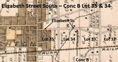
The south side of Elizabeth Street from Prince Edward Street all the way to South Pinnacle Street is in lot 35, concession B of the old Murray Township, later Brighton Township. The Patent from the crown for all 200 acres of lot 35, conc B, Murray Township was granted to Mathias Marsh (1761-1829). He was born in Amenia, Dutchess County, New York, a son of Col. William Marsh and Sarah French.
|
|
The family moved to Manchester, Vermont in 1777 because of the American Revolution and William Marsh ran a store there during the war, engaging in espionage in support of the British, but very discretely, so as not to be caught.
After the war was over, in 1783, Mathias Marsh married Sarah Richardson, of a Connecticut family who had also moved to Vermont. Mathias and Sarah lived at Manchester until about 1789 when they moved to Upper Canada and took up land grants in the south of Sidney Township. A sister of Mathias Marsh, Hannah Marsh, married Asa Weller in Manchester, Vermont in 1785 and they would move to the Quinte portage, also called the Carrying Place, in 1793 where Asa built and operated the batteau railway. We can expect that there was mutual support and collaboration between family groups in this pioneer setting.
Mathias Marsh had several land grants in Murray Township and this one in lot 35, concession B was sold in 1803 to William Lounsbury. This is a person for which there is very little information. I do not believe that he lived in this area and was probably a speculator rather than a loyalist with a bunch of land grants. We see this name only for a few years, just buying and selling.
After the war was over, in 1783, Mathias Marsh married Sarah Richardson, of a Connecticut family who had also moved to Vermont. Mathias and Sarah lived at Manchester until about 1789 when they moved to Upper Canada and took up land grants in the south of Sidney Township. A sister of Mathias Marsh, Hannah Marsh, married Asa Weller in Manchester, Vermont in 1785 and they would move to the Quinte portage, also called the Carrying Place, in 1793 where Asa built and operated the batteau railway. We can expect that there was mutual support and collaboration between family groups in this pioneer setting.
Mathias Marsh had several land grants in Murray Township and this one in lot 35, concession B was sold in 1803 to William Lounsbury. This is a person for which there is very little information. I do not believe that he lived in this area and was probably a speculator rather than a loyalist with a bunch of land grants. We see this name only for a few years, just buying and selling.
In 1815, William Lounsbury sold 100 acres out of lot 35 to John Singleton (1789-1837) who was a son of George Singleton and Nancy (Ann) McArthur. He was born in Thurlow Township, Hastings County, where the town of Belleville would grow. His father had been a soldier during the war and had come to Upper Canada after the war to conduct trade with the indigenous people north of the Bay of Quinte. Sadly, George Singleton died of fever just a few months after his son was born, and his mother later married Alexander Chisholm, an army buddy of the dead trader. They had no luck obtaining land grants at that location, so came to the north shore of Presqu’ile Bay as early as 1797 to establish saw and grist mills on what would be called Butler Creek. His mother received major land grants, including lot 35, concession A, and would be the defacto founder of Brighton, along with her son, John Singleton.
John Singleton married Margaret Canniff (1794-1886) who was a daughter of James Canniff and Elizabeth McBride of Cannifton, on the Moira River north of Belleville. The couple remained in Thurlow until around 1812 when they moved to be near his mother in the south end of Murray Township. Over the years, these folks would sell small village lots out of the larger township lots they had acquired through land grants, thus generating revenue for the family and kick-starting the community around them. In 1826, John and Margaret Singleton sold a half acre lot at the far north-west corner of lot 35, concession B to Richard Spencer (1797-1963) who was the son of Hazelton Spencer and Margaret Richards. This was a well-known loyalist family from Rhode Island and his father had been killed during the War of 1812.
John Singleton married Margaret Canniff (1794-1886) who was a daughter of James Canniff and Elizabeth McBride of Cannifton, on the Moira River north of Belleville. The couple remained in Thurlow until around 1812 when they moved to be near his mother in the south end of Murray Township. Over the years, these folks would sell small village lots out of the larger township lots they had acquired through land grants, thus generating revenue for the family and kick-starting the community around them. In 1826, John and Margaret Singleton sold a half acre lot at the far north-west corner of lot 35, concession B to Richard Spencer (1797-1963) who was the son of Hazelton Spencer and Margaret Richards. This was a well-known loyalist family from Rhode Island and his father had been killed during the War of 1812.
Several of the Spencer family were established in village lots on the east side of Prince Edward Street, just a bit south of the corner with Elizabeth Street. In 1835, Richard Spencer sold this half acre on the corner to Isaac Chamberlain Proctor (1790-1866), a son of Josiah Proctor and Susanna Chamberlain. He had been born in Vermont, where the family moved after the war, and by 1810, they were in Cramahe Township, soon acquiring land west of the border between Murray and Cramahe Townships which would much later be Prince Edward and Young Streets. The family was very active, like the Singletons, in selling village lots out of their township lots, and then using their wealth to speculate in land.
Isaac C. Proctor had married Elizabeth Smith (1797-1872) who was a daughter of John Drummond Smith and Elizabeth McDowall. Her family was a founder of the village of Smithfield, to the east of Brighton, and her mother was a daughter of the famous Reverend McDowall, a saddlebag minister in the early days when the minister rode across a wide area to preach the gospel and perform baptisms and marriages.
3 to 5 Elizabeth Street
|
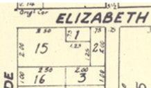
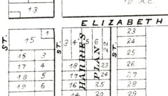
By 1866, the land east of Prince Edward Street and south of Elizabeth Street had been subdivided, leaving a large Lot 15 at the corner. The Brighton Plan of 1866 shows that lots 1 and 2 occupied smaller areas to the east of lot 15, and on the south side of Elizabeth Street, over to Oliphant Street.
|
|
Isaac C. Proctor died in 1866 and his son, William Chamberlain Proctor (1832-1913) inherited the property in lot 15 from the corner of Elizabeth Street and a short distance south. At the south end of this lot, William Proctor built a large and impressive brick house where he would live with other members of his family. He remained unmarried but had several siblings, including John Edward Proctor (1824-1911) who was building a business empire that would make him the richest man in Brighton. William C. Proctor worked with his brother, spending several years managing their trading firm in Toronto.
|
A further development can be seen in the 1878 Belden County Atlas where lots 1 and 2 are gone, with a remaining lot 1 right at the corner of Elizabeth and Oliphant Streets. This means that the properties along the south side of Elizabeth Street from Prince Edward and almost to Oliphant, are found in the lot 35 records. A good deal of sleuthing needs to be done to identify which records relate to which properties, but it can be done, eventually.
|
|
|
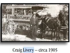
In 1911, Fred and Harry Craig purchased a livery business from Willet N. Simpson and moved into the barns along the south side of Elizabeth Street, a bit east of the corner. They managed a thriving business and in 1919, their father, George Craig (1842-1900) purchased the land up to the corner from the estate of Isaac Oscar Proctor (1836-1916), another brother of William C. and John E. Proctor. We see that the Proctor family owned this property at the corner from 1835 until 1919.
|
The Craig livery service was very popular during the years that people used horses, buggies and wagons for transportation. This all changed in the 1920s when the automobile took over the roads and the world changed dramatically. Within the next few decades, blacksmith shops would evolve into car repair shops and gas pumps became a common sight on the side of the street all around town.
|
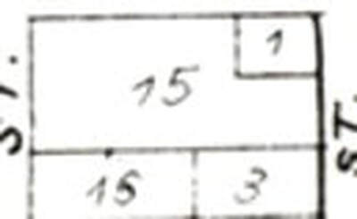
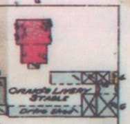
This segment of the 1926 Fire Map shows the large house on Prince Edward Street in red and the Craig Livery Stables that fronted onto Elizabeth Street but extended south behind the house. The Craig family lived in the big brick house. Notice that in 1926 the corner was open which would change as the era of gas stations impacted the streetscape.
|
|
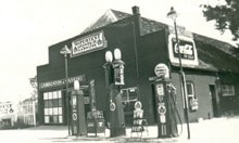
In 1933, the estate of George Craig leased part of the corner lot to Supertest for a new gas station. George Henry “Harry” Craig (1883-1923) was one of George Craig’s sons, and his second wife, Edith Violet Plumpton (1892-1969) would be active in managing the Craig property long after George died in 1923. Below is the Supertest station in 1939 when when it was sub-leased to Frank Pearsall (1811-1977), an ambitious young man who would later build the Pearsall Marina on Presqu’ile Bay.
|
|
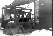
In 1942, Edith Craig leased the small lot on Elizabeth Street to Supertest once more, for a 10-year term and then re-leased to Pearsall. There was bad fire in February 1945 which destroyed six passenger cars and two trucks, including vehicles Pearsall used for his taxi business. The service station was quickly rebuilt and carried on business at 3 Elizabeth Street.
Edith Craig had also sold another part of the property, a bit farther east from the corner, to the Conger and Lehigh Coal Company who operated coal depots in various places around town during this time when coal was the primary method of heating homes and businesses.
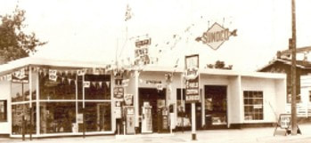
In 1948, Conger & Lehigh Coal Co. sold the property at 11 Elizabeth Street to Frank Pearsall and he proceeded to re-construct the business, called Pearsall Motor Sales and Sunoco Gas Station, see the picture at right. In 1960, the business moved to British Petroleum products was a dealer for Ford and Edsel cars. In 1978, this station had a major fire and Frank Pearsall moved his business to George Street.
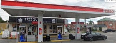
BP sold the property to Peter & Dawn North and they passed it on to George Brindakis where we would see Baker’s Dozen, and gas stations run by Petro-Canada and Ultramar.
These days, this corner hosts the Presqu’ile Café and Esso gas pumps. It is called 5 Elizabeth Street.
These days, this corner hosts the Presqu’ile Café and Esso gas pumps. It is called 5 Elizabeth Street.
11 Elizabeth Street
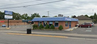
Today, Captain George’s Fish and Chips is at 11 Elizabeth Street, and occupies the property immediately east of the Esso station and on the south-west corner of Elizabeth and Oliphant Streets. The property that became 11 Elizabeth Street has the same history as 3 Elizabeth up to the point of Frank Pearsall building a new service station here after his station burned at the corner.
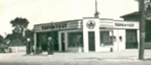
In 1979, after another destructive fire, Frank Pearsall sold the property at 11 Elizabeth Street to Martin Chittenden and after that, there are a series of numbered companies that keep the land records opaque.
We know that there was a Dixie Lee Chicken store here for a short time, 1995 and 1996. The Crow’s Nest Pub was here 2000 to 2003. There was another restaurant there for only a few months and then, in 2008, Captain George’s Fish & Chips operated at 11 Elizabeth Street and is still there in 2026.
We know that there was a Dixie Lee Chicken store here for a short time, 1995 and 1996. The Crow’s Nest Pub was here 2000 to 2003. There was another restaurant there for only a few months and then, in 2008, Captain George’s Fish & Chips operated at 11 Elizabeth Street and is still there in 2026.
13 Elizabeth Street
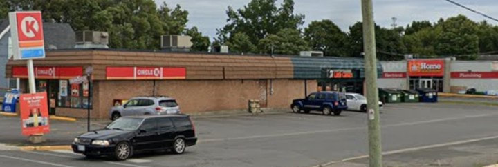
The property called 13 Elizabeth Street is on the east side of Oliphant Street at the corner of Elizabeth Street. Today, it is occupied by the Circle K variety store with Pare’s Home Hardware behind on Oliphant Street.
The history of this property is the same as the other land south of Elziabeth Street only in its earliest transactions. The difference comes in the 1827 transaction which shows that John Singleton sold 50 acres in the east part of the west part of lot 35 to Benjamin Way (1780-1870), a son of Daniel Way and Jemima Kilborn. He had come from Sophiasburgh Township and established himself at the south end of Murray township and began to engage in land speculation, not only in Brighton. Subdivision of the Murray Township lot into Brighton village lots happened in 1831, and it was not long before Benjamin Way sold village lot 15 on the east side of Oliphant Street to Isaac C. Proctor, who was always there to take advantage of the increase in demand for village lots. In 1842, he sold lot 15 to Augustus Daniel Barnabus Spencer (1806-1872) who was a son of Richard Spencer, up on the east side of Prince Edward Street.
There appears to have been little development in the area by 1855 when Spencer sold lot 15 to Isaac Maitland Wellington (1821-1897), who was a son of Josiah Dix Wellington and Elizabeth Gibson. His mother was a daughter of George Gibson, the early resident at Presqu’ile Point. She had married her father’s work partner, Charles Selleck and, after he died, she married a sailor recently arrived at Presqu’ile, Josiah Dix Wellington (1780-1865). Isaac M. Wellington owned a bakery at Main and Division Street for many years and would also be a local historian, publishing articles in the Ontario Historical Society Papers.
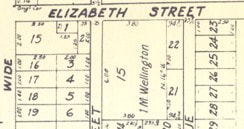
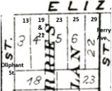
The 1866 Brighton Plan shows that the early subdivision here created lot 15 along the east side of Oliphant Street, at that time owned by Isaac Maitland Wellington. Then, the Belden County Atlas of 1878 shows the same space subdivided again, creating lots 3 to 6 along Elizabeth Street. Land records for these next few properties will be found in the section labelled “East side of Oliphant Street”.
|
|
The land records show that this new Plan was implemented on April 29 1873 which put the subdivisions into effect. Only a few days before that, on April 18, Isaac M. Wellington sold lot 15 to Cecil A. Harris, who quickly sold the new lots 3 and 4 to Henry Lewis (1839-1888). Mr. Lewis was a carriage maker and he established a carriage making shop on lots 3 and 4 in order to meet the need in the community for buggies, carriages, wagons, both in manufacturing new product for sale and providing repair and maintenance services for the vehicles and harnesses. It could be at this time that Mr. Lewis built the story-and-a-half brick house to the east side of this property, on lot 4, which is 19 Elizabeth St. today.
Henry Lewis died on May of 1888 and in July his wife, Jane, sold lots 3 and 4 to John Lear (1819-1889) who already had a home at 144 Main Street. He and his wife, Rhoda Anne Slight, had no children and when he died just two years later, John Lear’s estate passed the property on Elizabeth Street to his brother Joseph Lear, and Joseph’s son, William, Lear. The Lear family were on lots 3 and 4 until 1906 when William Lear sold them to Eleanor Snelgrove (1870-1942) who was the wife of James H. Snelgrove (1872-1953). Both lots changed hands again in 1912 when Eleanor Snelgrove sold them to Agnes M. Garbutt (1868-1932) who was the wife of William Isaac Garbutt.
Just two years later, Lots 3 and 4 were sold again, this time to Albert W. Taylor (1862-1943), a farmer near Hilton, who appears to have been providing a comfortable retirement home. At his death in 1943, the Taylor family was living at 13 Elizabeth Street and his estate would sell both lots in 1944 to Charles and Eva May Tompkins. Charles Arlington Tompkins (1889-1974) was a son of Norman Tompkins and Melissa Jane Snelgrove, farmers in the Hilton area. They had acquired a home on Perry Street where the kids grew up. Charles was now acquiring a home of his own near his parents.
Eva Tompkins died in 1966 and a few months later, Charles A. Tompkins sold both lots 3 and 4 to Frank Pearsall (1911-1977). One might wonder if Mr. Pearsall was considering this location for a new gas station as he had been involved in service stations to the west on Elizabeth Street. Whatever the objective, lots 3 and 4 were once again sold in 1969, to Clarence Edward Dale (1916-1987) who was a son of John Edward Dale and Alice May Chatterson. Clarence Dale was a well-known electrician in Brighton for many years on Oliphant Street and his son Ron continued with that business on Chapel Street.
Clarence Dale sold lots 3 & 4 in 1970 to Cloverlawn Investments. A few months later, lot 3 was sold to Imre J. & Magdolna Smith, with a second transaction at the same time for a small strip on the west side of lot 4, to add to the size of the property for commercial development.
Just two years later, Lots 3 and 4 were sold again, this time to Albert W. Taylor (1862-1943), a farmer near Hilton, who appears to have been providing a comfortable retirement home. At his death in 1943, the Taylor family was living at 13 Elizabeth Street and his estate would sell both lots in 1944 to Charles and Eva May Tompkins. Charles Arlington Tompkins (1889-1974) was a son of Norman Tompkins and Melissa Jane Snelgrove, farmers in the Hilton area. They had acquired a home on Perry Street where the kids grew up. Charles was now acquiring a home of his own near his parents.
Eva Tompkins died in 1966 and a few months later, Charles A. Tompkins sold both lots 3 and 4 to Frank Pearsall (1911-1977). One might wonder if Mr. Pearsall was considering this location for a new gas station as he had been involved in service stations to the west on Elizabeth Street. Whatever the objective, lots 3 and 4 were once again sold in 1969, to Clarence Edward Dale (1916-1987) who was a son of John Edward Dale and Alice May Chatterson. Clarence Dale was a well-known electrician in Brighton for many years on Oliphant Street and his son Ron continued with that business on Chapel Street.
Clarence Dale sold lots 3 & 4 in 1970 to Cloverlawn Investments. A few months later, lot 3 was sold to Imre J. & Magdolna Smith, with a second transaction at the same time for a small strip on the west side of lot 4, to add to the size of the property for commercial development.
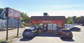
Then, in 1978, Imre Smith sold lot 3 to Mac’s Convenience and the Mac’s store was built there. Today, in 2026, there is a Circle K store at 13 Elizabeth Street. Pare’s Home Hardware was built at 11 Oliphant Street and bits of land were taken from the south end of lots 3 and 4 at that time.
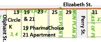
19 Elizabeth Street
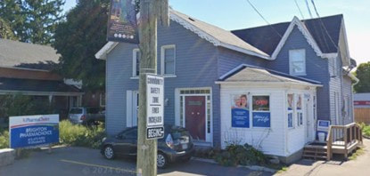
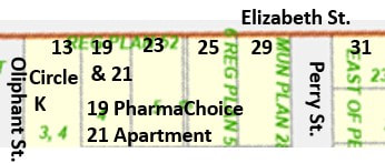
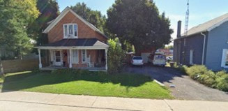
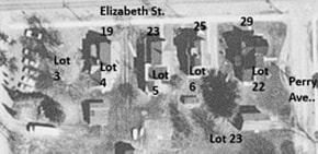
The building at 19 Elizabeth Street hosts two units which are separate and have different addresses. Brighton PharmaChoice pharmacy and drug store occupies the lower level with the entrance on the west side by the driveway and is 19 Elizabeth Street. The red door at the front, facing Elizabeth Street, is the entrance to a two-bedroom apartment that occupies the upper floor of the building and is 21 Elizabeth Street. At this point in 2026, the History Guy lives at 21 Elizabeth Street, with the grey Prius C parked out front.
This building is in Lot 4, East Side of Oliphant, and shares most of the same history as lot 3. Both front onto Elizabeth Street, but, historically, were part of Lot 15 East Side of Oliphant Street.
The building was built on the east side of Village Lot 4, probably in the time after 1873 when Henry Lewis owned both lots and had a carriage making shop. The shop would have been along Oliphant Street and the house to the east side of the two lots. The selling price for lots 3 and 4 together became $1,500 and soon $2,000 after the house was built.
The building was built on the east side of Village Lot 4, probably in the time after 1873 when Henry Lewis owned both lots and had a carriage making shop. The shop would have been along Oliphant Street and the house to the east side of the two lots. The selling price for lots 3 and 4 together became $1,500 and soon $2,000 after the house was built.
The 1965 Canada Voters Lists shows that Royal Quick and his wife Dorothy were living at 21 Elizabeth Street. In 1968 and 1972, they are shown to be living at 23 Elizabeth Street. The history of lot 4 diverges from lot 3 in 1978 when Imre Smith sold lot 3 to Mac’s Convenience. Records suggest that, at the same time, a small slice on the west side of lot 4 was taken from lot 4 and added to lot 3.
The drug store building that was built across the street, at 12 Elizabeth Street, was occupied by PharmaPlus which moved to 1 Main St. in 2005. At that time, PharmaSave remained at #12 but in 2008 moved across the street to 19 Elizabeth Street, becoming PharmaChoice. In preparation for this move, major renovations to the house were undertaken in 2008. That is when the upstairs apartment was created, which would be 21 Elizabeth Street.
In July 2024, Dan Buchanan became the tenant in 21 Elizabeth Street.
In July 2024, Dan Buchanan became the tenant in 21 Elizabeth Street.
23 Elizabeth Street
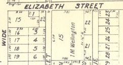
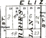
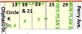
The house at 23 Elizabeth Street is located in Village Lot 5. The lot is actually on the south side of Elizabeth Street but the records are found under the East Side of Oliphant Street because its history goes back to the Plan in 1873 for subdivision of the old Lot 15 into smaller village lots.
|
|
Lot 15 had been sold to Cecil Harris before the subdivision, and after the Plan was put in place, he sold the village lots to buyers. Lot 5 went to Amos Greer Jones (1842-1894) in 1874. He was a son of James Jones & Margaret Parr, born on the family farm in Hillier Township. Amos Jones came to Brighton as a young man and worked as a grocer before being married to Nancy Victoria Davidson (1851-1883) a daughter of William Davidson and Elizabeth Ann Hill, farmers in Brighton Township. By 1881, Amos Jones was a carpenter/joiner, which means he was like modern contractors, building houses in the community.
Amos Jones also acquired village lot 6, just to the east and, in 1890, passed both lots to his second wife, Margaret “Maggie” Brisbin (1862-1944) who was from Picton, a daughter of Israel Brisbin and Jane Wilson. Maggie Brisbin and her husband’s estate sold both lots 5 & 6 in 1895 to John Brems (1851-1915) who operated dredging machines first on the Welland Canal and then on the Murray Canal.
Amos Jones also acquired village lot 6, just to the east and, in 1890, passed both lots to his second wife, Margaret “Maggie” Brisbin (1862-1944) who was from Picton, a daughter of Israel Brisbin and Jane Wilson. Maggie Brisbin and her husband’s estate sold both lots 5 & 6 in 1895 to John Brems (1851-1915) who operated dredging machines first on the Welland Canal and then on the Murray Canal.
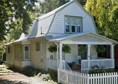
John Brems died in 1915 and his estate quickly sold village lots 5 & 6 to Joseph Royal Orin Quick (1884-1972) who was a son of Wesley Delbert Quick and Catharine Francis Purtill. His family was from Gosport and his father, Wesley Quick, had been a mariner or sailor. Royal Quick was married to Dorothy Helena Brown in 1921 and would engage in various business activities, including working with his brother, Grant Quick in the management of Presqu’ile Hotel and the associated facilities in the municipal section of Presqu’ile Point. The home at 23 Elizabeth Street is where he lived in retirement.
The 1965 Canada Voters Lists for 1965 shows that Royal Quick and his wife Dorothy were living at 21 Elizabeth Street. In 1968 and 1972, they are shown to be living at 23 Elizabeth Street.
Royal Quick died in 1972 and his wife, Dorothy sold lot 5 the next year to Jack & Dorothy Morris. The last transaction available in the public land records is in 2005 when Dorothy Pearl Morris sold lot 5 to Allan Leigh McMurdo, Deborah Leigh McMurdo and Matthew Leigh McMurdo. The same folks have a charge in 2007. This family has connections to the Pare family who built the hardware store on Oliphant Street.
Royal Quick died in 1972 and his wife, Dorothy sold lot 5 the next year to Jack & Dorothy Morris. The last transaction available in the public land records is in 2005 when Dorothy Pearl Morris sold lot 5 to Allan Leigh McMurdo, Deborah Leigh McMurdo and Matthew Leigh McMurdo. The same folks have a charge in 2007. This family has connections to the Pare family who built the hardware store on Oliphant Street.
25 Elizabeth Street
The property called 25 Elizabeth Street is mostly in village lot 6, but there is some overlap with lot 5 which can confuse the process. It is important to orient ourselves by saying that #25 is the second house west of Perry Street.
The 1878 map shows lots 5 and 6 numbered clearly, with lot 22 west side of Perry Street immediately east and lot 23 at the south end of these lots. Then, the OnLand.ca map shows the number “6” right on the boundary between the lots 5 and 6. This means there are two lines of ownership under the lot 6 records.
The history of village lot 6 is the same as lot 5 until 1915 when the estate of John Brems passed both lots 5 and 6 to his widow, Mary. Only two years later, in 1918, Mary Brems sold lot 6 to Agnes E. Stoneburg. This was Agnes E. Breeze (1872-1955), a daughter of Samuel Breeze and Elizabeth Huycke who farmed near Hilton. She married Herbert Manly Stoneburg, a druggist, in 1894 and they lived at 35 Perry Avenue but in the 1920s moved to Toronto.
Then, again only two years later, Agnes E. Stoneburg sold lot 6 to Andrew Hayes who turned it over quickly, selling to Frederick Biard Sprung (1885-1964) who was born in Ameliasburgh Township, a son of David Elgin Sprung and Charlotte Ellen “Ella” Weeks, farmers at Consecon. Fred was a baker by trade and he married Mina Olive French in 1912, with four children born while he worked in Consecon. Around 1920, the family moved to Brighton and Fred was involved in grocery and bakery businesses at 24 and 28 Main Street. Around 1930, the family moved to Belleville where Fred was a “merchant in a confectionary store.”
The history of village lot 6 is the same as lot 5 until 1915 when the estate of John Brems passed both lots 5 and 6 to his widow, Mary. Only two years later, in 1918, Mary Brems sold lot 6 to Agnes E. Stoneburg. This was Agnes E. Breeze (1872-1955), a daughter of Samuel Breeze and Elizabeth Huycke who farmed near Hilton. She married Herbert Manly Stoneburg, a druggist, in 1894 and they lived at 35 Perry Avenue but in the 1920s moved to Toronto.
Then, again only two years later, Agnes E. Stoneburg sold lot 6 to Andrew Hayes who turned it over quickly, selling to Frederick Biard Sprung (1885-1964) who was born in Ameliasburgh Township, a son of David Elgin Sprung and Charlotte Ellen “Ella” Weeks, farmers at Consecon. Fred was a baker by trade and he married Mina Olive French in 1912, with four children born while he worked in Consecon. Around 1920, the family moved to Brighton and Fred was involved in grocery and bakery businesses at 24 and 28 Main Street. Around 1930, the family moved to Belleville where Fred was a “merchant in a confectionary store.”
There are several very quick transactions until lot 6 goes to John Tinson (1868-1947), an Englishman who, with his wife Fanny, had arrive in Montreal in May 1903 with the plan to head to Brighton. John worked as a gardener and the couple remained childless. In 1921, they purchased lot 6, on the south side of Elizabeth Street from Caleb French and they lived here until selling in January 1945 to Lily B. and Lola Adams, soon after Fanny Tinson died. John Tinson died in Belleville Hospital in August 1947.
Lillie Beatrice Loveless (1882-1971) was a daughter of Reuben Loveless and Adeline Irish, longtime farmers in the area. In 1903, Lilly married William Curtis Adams (1882-1960) who was born in England and would be engaged in many different businesses in Brighton, from fruiter to furniture merchant and operator of the pool hall. Lola Gene Adams (1906-2003) was a daughter of William and Lilly, and we can see her in a picture of telephone operators in the Telephone Exchange office in Brighton in 1928. She married John Norman “Jack” Lackaye (1918-1962) who was from Perth, Lanark County, and Lola was his second marriage.
The Canada Voters Lists for 1965 shows both Mrs. William Adams and Mrs. Lola LacKaye living at 25 Elizabeth Street. This would be mother and daughter. She married John Norman “Jack” Lackaye (1918-1962) who was from Perth, Lanark County, and Lola was his second marriage. The Canada Voters Lists for 1968 shows Mrs. William Adams by herself at 25 Elizabeth St.
The Canada Voters Lists for 1965 shows both Mrs. William Adams and Mrs. Lola LacKaye living at 25 Elizabeth Street. This would be mother and daughter. She married John Norman “Jack” Lackaye (1918-1962) who was from Perth, Lanark County, and Lola was his second marriage. The Canada Voters Lists for 1968 shows Mrs. William Adams by herself at 25 Elizabeth St.
Rose Loveless (1894-1976) was born in Newfoundland and immigrated to Ontario in 1922. She married Ross Loveless in 1927 and they farmed at R.R. # 4, Brighton. Ross Loveless (1886-1952) was a brother of Lilly Beatrice Loveless (1882-1971) who married William Curtis Adams and they were parents of Lola Gene Adams (1906-2003) who married John Norman “Jack” LacKaye (1918-1962), his 2nd wife. So, Rose would be Lola’s aunt.
In 1984, Lola LacKaye sold 25 Elizabeth Street to Heather A. Hooper & Steven J. Simpson (1961-2016). Steven was a son of Darwin James “Bud” Simpson and Margaret Elizabeth Post. In 1966, these folks sold #25 to a numbered company and there are several charges and discharges listed, leading eventually, in 1996, the sale of the property to Norman Roy Tozer.
In 2001, Corenna Tozer sold to Robert Trottman and in 2007, he sold to Leonard Martin & Eva Landry.
In 2001, Corenna Tozer sold to Robert Trottman and in 2007, he sold to Leonard Martin & Eva Landry.
29 Elizabeth Street
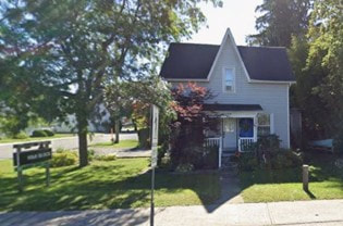
There is a fine frame house at 29 Elizabeth Street which faces north onto Elizabeth Street. This property is part of Lot 22 on the west side of Perry Street, a long lot that goes south and contains several separate properties, as shown in the aerial photo at right. The history of this lot is the same as the lots to the west until 1856 when Isaac C. Proctor sold lot 22 to Josiah H. Proctor, is brother, who quickly sold the lot to John H. Perry.
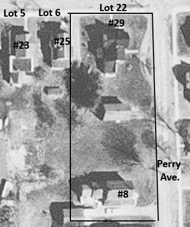
John Ham Perry (1829-1896) was originally from the Bath area and was a son of Peter Perry and Mary Ham. He married Jane Margaret Hall in 1852 in Kingston but settled in Whitby where he made a career as the Registrar. In this position, he was able to purchase strategically located town lots in Brighton, including Lots 22 and 23 on the west side of what would be called Perry Street, both acquired in 1856.
John H. Perry owned Lot 22 until 1871 when he sold it to Robert Barker, a druggist in Brighton. Mr. Barker already had a fine home on Main Street along with his drug store, so it appears this was an investment. He then sold Lot 22 to Nancy V. Jones in 1879. Nancy Victoria Davidson (1851-1895) was a daughter of William Davidson and Elizabeth Ann Hill and was married in 1871 to Amos Greet Jones (1842-1894). Mr. Jones was a carpenter joiner or, in modern terms, a builder or contractor. Nancy v. Jones owned Lot 22 until 1895 when it was sold to John Brems.
John Brems (1851-1915) was called a “dredgeman” or a “dredge engineer” which means that he operated large steam-powered dredging machines. He was working on the Welland Canal before moving his family to Brighton in the early 1880s to work on the building of the Murray Canal. When he retired, he remained in Brighton and in 1910 sold Lot 22 to William F. Craig.
John Brems (1851-1915) was called a “dredgeman” or a “dredge engineer” which means that he operated large steam-powered dredging machines. He was working on the Welland Canal before moving his family to Brighton in the early 1880s to work on the building of the Murray Canal. When he retired, he remained in Brighton and in 1910 sold Lot 22 to William F. Craig.
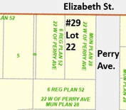
William Frederick Craig (1873-1937) was a son of George Craig and Charlotte Lee, farmers on Presqu’ile Point. Fred and his brother George established their livery and stage coach business in 1911 at the corner of Prince Edward and Elizabeth Street, on the south side of Elizabeth Street, beside the old Proctor house. George Craig lived in the big brick house and brother Frederick lived down the street on Lot 22, which would become 29 Elizabeth Street.
In 1937 the property was sold to Fred’s son, Newell Kenneth Craig (1896-1941) who worked as a CPR Expressman for 29 years. Newell Craig’s estate sold Lot 22 in 1955 to Oscar Van Blaricom (1900-1957) who farmed in the Codrington area but worked as a mail carrier in Brighton for several years. His wife, Mary, sold the property in 1991 to Balram Kissoon.
31 Elizabeth Street
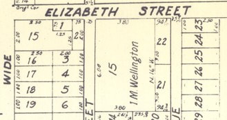
The house at 31 Elizabeth Street is at the south-east corner of Elizabeth Street and Perry Avenue. There were a series of similar lots along the east side of Perry Ave, as can be seen in the 1866 map at right. Lot 23 occupies the front on Elizabeth Street east of Perry Ave., but is associated to Perry Ave. East in the records, and not Elizabeth Street.
Lot 23 shares the same history as Lot 22 including 1856 when Josiah H. Proctor sold this ¼ acre lot to John H. Perry. As we have seen, Mr. Perry also had Lot 22 along the west side of Perry Ave. and that the street as named for him.
In 1869, John H. Perry sold Lot 23 to Joseph Clouston who held it for only two years, selling in 1871 to Gilbert Taylor. Joseph Clouston (1840-1912) was apparently making a quick investment at a time when he was getting started as a carriage maker in Brighton. He would still be in that capacity according to the 1911 Census, only a year before he died. Interestingly, his father was William Clouston (1795-1866) who had been Post Master for the Hudson Bay Company from 1812, when he came to Canada from Scotland as a 17-year-old, until he retired in 1843. After retirement, William Clouston purchased 20 acres of land at the south end of lot 10, Concession 1, Brighton Twp., where he and his wife, Angeline Morrison raised their family of 6 children.
Gilbert Taylor (1820-1902) was from Ameliasburgh Twp. but moved to the south end of Murray Twp. before marrying Mariah Carscellan in 1850. He farmed there and raised a family until moving back to the County in his 60’s. In the meantime, he engaged in short-term investments, such as this one for Lot 23, Perry St. East which he turned around quickly in 1881, selling to Isaac Post.
Isaac C. Post (1816-1883) was born in Hillier Township, Prince Edward County, a son of Jacob Post and Maria Rita Quackenbush. He married Jemima Parliament in Ameliasburgh Township in 1838 and they would go on to have ten children while Isaac engaged in farming. In 1865, Isaac purchased the west half 100 acres of Lot 9, Concession 1, Brighton Township, which was a little back from the lakeshore to the west of Brighton Village.
In March 1881, Isaac Post purchased Village Lot 23, Perry Avenue, East Side, from Gilbert Taylor. He appears to have lived on the farm near the lakeshore and died there March 22, 1883. His son, Walter Stewart Post was married in 1879 and the same property, described as “1/4 acre”, was sold to Walter S. Post, for $600 in 1883. The difference in price may suggest a house having been built on the lot. Walter owned the property less than two years, selling in January 1885 to Thomas Webb. Walter and his wife Matilda move to Seymour Township in 1889.
W. Thomas Webb (1835-1909) was a very successful dry goods merchant in Brighton and the quick turn-around of Lot 23 Perry Avenue East Side was one of many investments he made in local properties with a view to turning a profit. Within a few months, he sold Lot 23 to Hannah Jane Hare (1857-1914) who was the wife of Wellington Rober Hare, who operated a blacksmith shop on Young street.
In 1869, John H. Perry sold Lot 23 to Joseph Clouston who held it for only two years, selling in 1871 to Gilbert Taylor. Joseph Clouston (1840-1912) was apparently making a quick investment at a time when he was getting started as a carriage maker in Brighton. He would still be in that capacity according to the 1911 Census, only a year before he died. Interestingly, his father was William Clouston (1795-1866) who had been Post Master for the Hudson Bay Company from 1812, when he came to Canada from Scotland as a 17-year-old, until he retired in 1843. After retirement, William Clouston purchased 20 acres of land at the south end of lot 10, Concession 1, Brighton Twp., where he and his wife, Angeline Morrison raised their family of 6 children.
Gilbert Taylor (1820-1902) was from Ameliasburgh Twp. but moved to the south end of Murray Twp. before marrying Mariah Carscellan in 1850. He farmed there and raised a family until moving back to the County in his 60’s. In the meantime, he engaged in short-term investments, such as this one for Lot 23, Perry St. East which he turned around quickly in 1881, selling to Isaac Post.
Isaac C. Post (1816-1883) was born in Hillier Township, Prince Edward County, a son of Jacob Post and Maria Rita Quackenbush. He married Jemima Parliament in Ameliasburgh Township in 1838 and they would go on to have ten children while Isaac engaged in farming. In 1865, Isaac purchased the west half 100 acres of Lot 9, Concession 1, Brighton Township, which was a little back from the lakeshore to the west of Brighton Village.
In March 1881, Isaac Post purchased Village Lot 23, Perry Avenue, East Side, from Gilbert Taylor. He appears to have lived on the farm near the lakeshore and died there March 22, 1883. His son, Walter Stewart Post was married in 1879 and the same property, described as “1/4 acre”, was sold to Walter S. Post, for $600 in 1883. The difference in price may suggest a house having been built on the lot. Walter owned the property less than two years, selling in January 1885 to Thomas Webb. Walter and his wife Matilda move to Seymour Township in 1889.
W. Thomas Webb (1835-1909) was a very successful dry goods merchant in Brighton and the quick turn-around of Lot 23 Perry Avenue East Side was one of many investments he made in local properties with a view to turning a profit. Within a few months, he sold Lot 23 to Hannah Jane Hare (1857-1914) who was the wife of Wellington Rober Hare, who operated a blacksmith shop on Young street.
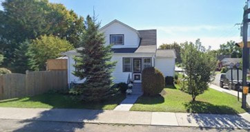
Melissa Jane Snelgrove (1855-1036) was a daughter of Robert Snelgrove and Mary Marion McMaster who farmed in Brighton Township. She married Norman Jesse Tompkins in 1875 and they had three children while farming near Hilton. Melissa engaged in real estate speculation, some of it with Village Lots 7 and 8 on Elizabeth Street. She acquired Lot 23, or 31 Elizabeth Street. in 1906 and her estate passed it on in 1936 to her daughter, Clara E. (Tompkins) Adams, wife of Frank Adams.
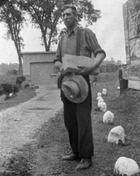
Then, in 1945, Clara Adams sold Lot 23 to Frank Everett Goodrich (1895-1969) who was married to Eva Alice Walker and farmed in Cramahe Township west of Hilton. However, the purchase of Lot 23 was in support of the family moving to Brighton so Frank could operate a saw mill called the Cheer Yard on Alice Street.
At right is a picture of Frank Goodrich around 1930 or so. It is part of the Latimer Photos, taken by Hugh Latimer of Orland. In 1957, Frank Goodrich became Reeve of Brighton Village, where he served until 1961. Sadly, his wife, Eva died in June 1959. Not long afterward, on July 28, 1959, a special event occurred. Queen Elizabeth came down No. 2 Highway, right past the Goodrich home at 31 Elizabeth Street. Marjorie Morgan, a daughter of Frank and Eva Goodrich, said that the house was adorned with liberal amounts of bunting.
At right is a picture of Frank Goodrich around 1930 or so. It is part of the Latimer Photos, taken by Hugh Latimer of Orland. In 1957, Frank Goodrich became Reeve of Brighton Village, where he served until 1961. Sadly, his wife, Eva died in June 1959. Not long afterward, on July 28, 1959, a special event occurred. Queen Elizabeth came down No. 2 Highway, right past the Goodrich home at 31 Elizabeth Street. Marjorie Morgan, a daughter of Frank and Eva Goodrich, said that the house was adorned with liberal amounts of bunting.
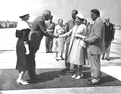
Since Frank was Reeve of Brighton, he was invited to meet the Queen on the tarmak at Trenton Forces Base. Unfortunately, his wife was not able to accompany him, so his daughter, Marjorie, went in her place. Marjorie told me of her excitement and nervousness at meeting the Queen. How did her dress look? Did she curtsy properly? Would she embarrass her father who she loved dearly. The meeting went well and Marjorie had a unique story to tell.
Here is a very unique photo of the moment on the tarmac when Frank Goodrich is shaking the hand of the Queen. Marjorie, dressed for the occasion, stands watching intently. She is next! Unconsciously, her right foot is poised for the perfect curtsy that was coming.
Here is a very unique photo of the moment on the tarmac when Frank Goodrich is shaking the hand of the Queen. Marjorie, dressed for the occasion, stands watching intently. She is next! Unconsciously, her right foot is poised for the perfect curtsy that was coming.
Frank Goodrich died in 1969 and Marjorie and her husband, Art Dorland, sold 31 Elizabeth Street to Derek and Pauline Matthews. In 1986, they sold it to Patricia McHenry & Patrick Tobey who then sold it in 1991 to Gaspard & Gloria Plourde. Then, in 1992, National Trust passed it to Glenn Stevenson, and in 1998, he sold to Richard Jackson. Two years later it went to Rebecca Jackson-Guy who sold in 2006 to Lawrence Chapman & Penny Bailey.
35 Elizabeth Street
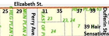
The property called 35 Elizabeth Street is the second house east of Perry Ave., located in the eastern part of Lot 23, East side of Perry Ave. and the north part of Lot 24, Elizabeth St. South.
Land Registry Records for #35 are identical to that of #31 until 1970 when Harold and Marjorie Morgan sold this eastern part of lot 23 to Patrician M. Wharton. As seen above under #31, the western part of lot 23, went to Derek & Pauline Matthews.
Then, in 1971, this property, called “easterly 56 feet of said lot”, went to Douglas A. & Rose J. Rutt. They are described as “retired” in the 1972 Canada Voters Lists and living at 35 Elizabeth Street.
Then, in 1971, this property, called “easterly 56 feet of said lot”, went to Douglas A. & Rose J. Rutt. They are described as “retired” in the 1972 Canada Voters Lists and living at 35 Elizabeth Street.
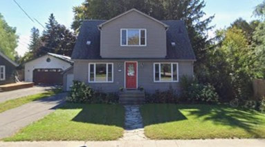
In 1976, #35 was sold to Wilbert E. Webster “to uses” for $2 and he sold it in 1981 to Albert E. & Mary E. Blight, again for $2. There is a Housing Development Lein in 1982 which may mean major renovations. Then the Blight’s sold #35 to William & Shirley Dye in 1863.
No. 35 was then sold in 1988 to Robert E. Lee & Shannon Emerald Rosniak who sold it in 2007 to James Robert Dawsson & Vanessa Holdman.
No. 35 was then sold in 1988 to Robert E. Lee & Shannon Emerald Rosniak who sold it in 2007 to James Robert Dawsson & Vanessa Holdman.
37 Elizabeth Street
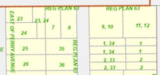
The house at 37 Elizabeth Street is contained within Village Lot 7 which fronts on Elizabeth Street and extends south to form a deep lot. Lot 8 to the east goes up to Dufferin Street. This takes us east of the lots along the east side of Perry Avenue.
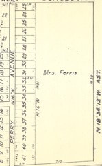
Isaac Chamberlain Proctor (1790-1866) had acquired 50 acres in the north part of Lot 35, Concession B in 1831, in what was then Murray Township but became Brighton Township January 1, 1852. At this time, he was dealing out parcels of land to other investors, in this case his own daughter, Sarah Elizabeth Proctor (1839-1882) who had married Matthew M. Ferris in 1860. Mr. Ferris was already a prosperous dry goods merchant with a large store on the south-east corner of Prince Edward and Dundas Streets. The Proctor and Ferris families would be primary movers-and-shakers in Brighton real estate and merchandizing for several decades.
A snip from the 1866 Brighton Plan shows that Mrs. Ferris owned a large section of land between Elizabeth Street and the railway tracks and between the East Perry Avenue lots and what became Pinnacle St. South to the east.
The land records for Lot 7 are the same as the properties to the west only until 1862 when Isaac C. Proctor sold 10 acres in the north-east part of Lot 35, Concession B to Elizabeth Ferris.
The land records for Lot 7 are the same as the properties to the west only until 1862 when Isaac C. Proctor sold 10 acres in the north-east part of Lot 35, Concession B to Elizabeth Ferris.
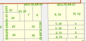
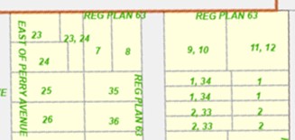
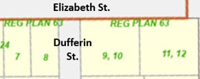
The map at right from OnLand.ca, the Ontario Land Registry Records website, shows that Lots 7 and 8 were part of Plan 63 which was implemented in 1878, subdividing the larger lot into smaller village lots. Plan 63 went east to Pinnacle Street with Village Lots 9 and 10 and 11 and 12. More lots were created south to the railway. A quote from the records says this created “… subdivisions of part of said lot marked with the name of Mrs. Ferris on Webb’s Plan of Brighton.”
In 1878, Matthew and Elizabeth Ferris sold Village Lots 7 and 8 to Walter N. Davidson who sold them quickly to Abel Snelgrove. Walter Nichol Davidson (1852-1936) was not part of the well-known Davidson family north of Brighton, but came from Scotland as a child around 1855 when his parents brought a large family to settle in Seymour Township. Walter Davidson had no interest in farming and by the age of 24, in 1876, took up residence in the village of Brighton and opened a tailor’s shop. It appears as if he was immediately successful, operating his shop at 17 Main Street up to 1909. In this context, he engaged in real estate speculation, immediately turning around Lots 7 and 8 to Abel Snelgrove.
Thomas “Abel” Snelgrove (1854-c. 1925) was engaged in speculation with various properties in and around Brighton, including Lots 7 and 8 and Lot 23 on the south side of Elizabeth Street. In the case of Lot 7, however, the property stayed in the family for several decades. In 1889, Abel Snelgrove sold Lot 7 to Melissa J. Tompkins who was his sister, married to Norman Jesse Tompkins, a farmer near Brighton. At appears as if, for Norman and Melissa Tompkins, this was a retirement home.
Mellissa died in 1936 and her Will granted Lot 7 to her grandson, Norman “Lyle” Brooks, a son of Allen Edgar Brooks and Alma Edith Tompkins. Lyle Brooks sold Lot 7 in 1944 to William and Jessie Lawson. William James Lawson (1891-1951) was son of Charles Lawson and Flora Ann Buck, and was part of a large loyalist family, going back to Matthew Lawson who settled in the early 1800s on the north shore of Presqu’ile Bay, in what would be called Lawson Settlement.
Thomas “Abel” Snelgrove (1854-c. 1925) was engaged in speculation with various properties in and around Brighton, including Lots 7 and 8 and Lot 23 on the south side of Elizabeth Street. In the case of Lot 7, however, the property stayed in the family for several decades. In 1889, Abel Snelgrove sold Lot 7 to Melissa J. Tompkins who was his sister, married to Norman Jesse Tompkins, a farmer near Brighton. At appears as if, for Norman and Melissa Tompkins, this was a retirement home.
Mellissa died in 1936 and her Will granted Lot 7 to her grandson, Norman “Lyle” Brooks, a son of Allen Edgar Brooks and Alma Edith Tompkins. Lyle Brooks sold Lot 7 in 1944 to William and Jessie Lawson. William James Lawson (1891-1951) was son of Charles Lawson and Flora Ann Buck, and was part of a large loyalist family, going back to Matthew Lawson who settled in the early 1800s on the north shore of Presqu’ile Bay, in what would be called Lawson Settlement.
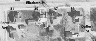
William and Jessie Lawson farmed east of Brighton but also speculated on properties in Brighton, including commercial space at 1 Young Street and Lot 7 or 37 Elizabeth Street. No. 37 is the second house west of Dufferin Street as can be seen in the aerial photo of the area at right.
In 1949, William and Jessie Lawson sold Lot 7 to cousins Roswell Lawson and his wife Nettie Kemp. Roswell Clarke “Ross” Lawson (1876-1961) was a son of Monroe Lawson and Harriet Amelia Wheatley, married to Nettie Amelia Kemp in 1901. Their daughter, Phyllis Marie Lawson (1902-1976) was shown to be resident at 37 Elizabeth Street in the 1965 and 1968 Canada Voters Lists. In 1970, Phyllis Lawson sold Lot 7 to Brendan G. & Betty J. Burton. Brendan “Bert” Burton was married in 1956 to Betty Joice Waddling (1938-2015), a daughter of Alfred Henry Waddling and Marjory Irene Smith. Betty was also a sister of Ron Waddling, a well-known artist in Brighton.
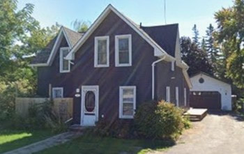
The property at 37 Elizabeth Street was sold again in 1978, this time to Jessie Kulaska. This owner remained for a decade and then sold in 1988 to Fletcher Godfrey Deline, Aletha Gertrude Deline & Carl Godfrey Deline. Then, in 2001, Lot 7 was sold under Power of Sale to John Cedrone who sold in 2005 to Jayne Anne Lacroix & Francis Anthony Miller.
39 Elizabeth Street
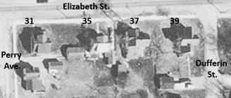
The property at 39 Elizabeth St. is on the south-west corner of Elizabeth and Dufferin Streets, in Village Lot 8. This snip of an aerial photo from the 1960s shows houses at both #37 and #39, before the development of the commercial building at #39 in the 1990s.
Lot 8 shares transactions with Lot 7 until 1889. At that point, Abel Snelgrove sold Lot 8 to Emma Snelgrove, wife of his brother, John W. Snelgrove. Emma Marsh (1850-1914) was a daughter of Darius Marsh and Elizabeth McMahon. John Wesley Snelgrove (1847-1935) was a brother of Abel’s, married to Emma Marsh.
Then, in 1896, John and Emma sold Lot 8 to James and Alonzo Simpson and they sold the next year to Melissa J. Tompkins. So, in a more round-about way, Lot 8 and Lot 7 were both in the hands of Melissa (Snelgrove) Tompkins, a sister of both John and Abel.
Lot 8 was the home of the Snelgrove family even after Melissa Tompkins sold it to Alma E. Brooks in 1931. Elma Edith Tompkins (1883-1951) was a daughter of Norman and Melissa Tompkins and she had married Allen Edgar Brooks (1879-1959) in 1903, he working as a carpenter in Brighton. In 1951, the estate of Alma Brooks sold 39 Elizabeth Street to her husband, Allen E. Brooks and then his estate sold it to Courtney E. Cozens in 1958. Charles C. and Courtney C. Cozens sold it in 1961 to Roger O. and Lorena M. Dainard and they sold in 1973 to William F. Robinson. This last period from 1961 to 1973 would see tenants living in 39 Elizabeth Street. Mrs. Gladys Fox was there according to the 1965 and 1968 Canada Voters Lists and James and Marjorie Waddling are there for the 1971 Voters Lists. Let’s recall that Marjorie Joice (Waddling) Burton and husband Bert owned Lot 7 at this time as well.
A month after he acquired Lot 8, William F. Robinson sold it to Nelson & Hilda Seward who sold it in 1976 to Peter Kulaszka. In 1988 Lot 8 went to Verna May Gill and a year later, back to Peter Kulaszka and then quickly to Mathew John Walas, a developer in Brighton.
Lot 8 was the home of the Snelgrove family even after Melissa Tompkins sold it to Alma E. Brooks in 1931. Elma Edith Tompkins (1883-1951) was a daughter of Norman and Melissa Tompkins and she had married Allen Edgar Brooks (1879-1959) in 1903, he working as a carpenter in Brighton. In 1951, the estate of Alma Brooks sold 39 Elizabeth Street to her husband, Allen E. Brooks and then his estate sold it to Courtney E. Cozens in 1958. Charles C. and Courtney C. Cozens sold it in 1961 to Roger O. and Lorena M. Dainard and they sold in 1973 to William F. Robinson. This last period from 1961 to 1973 would see tenants living in 39 Elizabeth Street. Mrs. Gladys Fox was there according to the 1965 and 1968 Canada Voters Lists and James and Marjorie Waddling are there for the 1971 Voters Lists. Let’s recall that Marjorie Joice (Waddling) Burton and husband Bert owned Lot 7 at this time as well.
A month after he acquired Lot 8, William F. Robinson sold it to Nelson & Hilda Seward who sold it in 1976 to Peter Kulaszka. In 1988 Lot 8 went to Verna May Gill and a year later, back to Peter Kulaszka and then quickly to Mathew John Walas, a developer in Brighton.
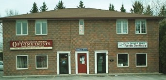
We see a By-Law passed in 1993 related to Plan 63 which was created “To authorize the Mayor and Clerk to execute a site plan agreement between the town and M. Walas”. This indicates the change of Lot 8, 39 Elizabeth Street, from residential to commercial as the process began to remove the old house and build the small commercial plaza that we see there today at the corner of Dufferin Street.
There have been numerous tenants in this building, notably Hair Sensations which operated at 6 Oliphant Street from 1997 to 2008 when it moved to 39 Elizabeth Street and remains to this writing in 2026.
41 Elizabeth Street
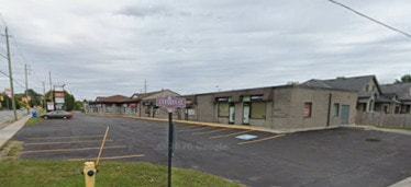
Today there is a modern commercial plaza at 41 Elizabeth Street, at the north-east corner of Dufferin and Elizabeth Streets. However, for history of this property we need to look at the 1866 Brighton Plan which shows that this area from the Perry Avenue East lots all the way east to Pinnacle St. South was owned by Mrs. Ferris.
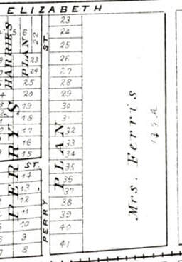
Elizabeth (Proctor) Ferris, wife of Matthew Ferris, acquired this property from Isaac C. Proctor in 1862.
A few years later, in 1878, the Belden County Atlas map of Brighton Village shows the same thing, Mrs. Ferris has 13 1/3 acres between Elizabeth Street and the railway tracks. Then, in November 1878, Plan 63 is implemented “Showing subdivisions of part of said lot marked with the name of Mr. Ferris on Webb’s Plan of Brighton”
Around the same time, Matthew and Elizabeth Ferris sold Village Lots 10 and 11 to William Kelly. A few months later, they sold Lot 12 to the same buyer. Apparently there were mortgage problems since in 1888 James L. Biggar was granted Lot 10 and 11 to George S. Miller for $130. Besides this, In 1890 William Kelley granted Lots 10, 11 and 12 to Matthew Ferris for $5. On 1895, George S. Miller granted Lots 10 and 11 to Jennie E. Webb, Francis M. Snelgrove, Mary E. Sanford and Margaret I. Ferris for the same $130.
A few years later, in 1878, the Belden County Atlas map of Brighton Village shows the same thing, Mrs. Ferris has 13 1/3 acres between Elizabeth Street and the railway tracks. Then, in November 1878, Plan 63 is implemented “Showing subdivisions of part of said lot marked with the name of Mr. Ferris on Webb’s Plan of Brighton”
Around the same time, Matthew and Elizabeth Ferris sold Village Lots 10 and 11 to William Kelly. A few months later, they sold Lot 12 to the same buyer. Apparently there were mortgage problems since in 1888 James L. Biggar was granted Lot 10 and 11 to George S. Miller for $130. Besides this, In 1890 William Kelley granted Lots 10, 11 and 12 to Matthew Ferris for $5. On 1895, George S. Miller granted Lots 10 and 11 to Jennie E. Webb, Francis M. Snelgrove, Mary E. Sanford and Margaret I. Ferris for the same $130.
This is a group of siblings and who had their names used by their husbands in the execution of real estate investment projects. Elizabeth Jane “Jennie” Ferris (1861-1928) was a daughter of Matthew Ferris and Sarah Elizabeth Proctor, married to Harry Clifford Webb, a merchant in Brighton. Mary Ellen Ferris (1865-1931) was a sister of Jennie’s, married to Charles Marcus Sanford (1862-1916), a doctor in Brighton. Frances Maud Ferris (1869-1927) was another sibling of Jennie and Mary, married to Major Henry John Snelgrove, a journalist in Cobourg. Margaret Irene Ferris (1873-1948) was another sibling along with Jennie, Mary and Frances, although Margaret remained unmarried and was much involved in family real estate deals.
The confusion continues in 1912 as Jennie E. Webb sold Lots 11 and 12 to Margaret J. Ferris, along with lots on Lambton Street. At the same time, Jennie E. Webb sold Lots 9 and 10, Elizabeth Street South to Charles M. Sanford for $300.
Then, in 1925, Lots 9, 10, 11 and 12 were in a long list of lots sold by the Estate of Mary E. Sanford to Richard E. Chatterson. Richard Esley Chatterson (1858-1928) was a son of George Hogel Chatteson and Emmeline Rouse, married in 1880 to Alfred Elizabeth “Freida” Alexander (1860-1941), farmers in Cramahe Township but with real estate interests in Brighton Township and Brighton Village. In 1928, Freida Chatterson sold all four lots to Olivia M. Shortt.
Olivia M. Franklin (1879- ) was a daughter of David James Franklin and Mary Mahala Banta. Her father had been born in Brighton Township, a son of Benjamin Franklin, owner of several mills in Brighton, in particular woolen mills in Brighton village and west of Newcombs Mills. However, David Franklin moved to Michigan and Olivia was born in Lapeer Co., Michigan although was married in Brighton in 1897 to Sherley E. Shortt, part of a very early settler family in this area.
Olivia Shortt was living in Rochester at the time of these transactions related to the four lots on Elizabeth Street, and in 1929 her father, David Franklin and her son Raymond Shortt sold the lots to Alfreda Chatterson.
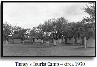
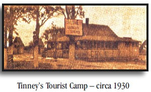
A mortgage provided by Alfreda Chatterson resulted in her acquisition of “Lots 9 to 12 south side of Elizabeth St.” and then she sold them in 1930 to Eva V. Asling. Eva Viola Asling (1892-1971) was the daughter of Ralph Widmer Asling and Frances Harrison and was born in Uxbridge where her father made pianos. The 1931 Census shows that Eva is one of the owners of a tourist camp on Elizabeth Street in Brighton. Albert Victor Tinney is listed next and is called an employer at the same camp. Tom Fariman is another employer and May Chatten is described as a cook.
Eva and Albert took over an existing facility that is described as “Cabins & Service Station. The next important event was dated February 11, 1932 when Albert Victor Tinney and Eva Viola Asling were married in Watertown, New York. Under Tinney ownership, improvements were made including “In 1932 a kitchen and a shower bath to accommodate guests.”
Olivia M. Franklin (1879- ) was a daughter of David James Franklin and Mary Mahala Banta. Her father had been born in Brighton Township, a son of Benjamin Franklin, owner of several mills in Brighton, in particular woolen mills in Brighton village and west of Newcombs Mills. However, David Franklin moved to Michigan and Olivia was born in Lapeer Co., Michigan although was married in Brighton in 1897 to Sherley E. Shortt, part of a very early settler family in this area.
Olivia Shortt was living in Rochester at the time of these transactions related to the four lots on Elizabeth Street, and in 1929 her father, David Franklin and her son Raymond Shortt sold the lots to Alfreda Chatterson.
A mortgage provided by Alfreda Chatterson resulted in her acquisition of “Lots 9 to 12 south side of Elizabeth St.” and then she sold them in 1930 to Eva V. Asling. Eva Viola Asling (1892-1971) was the daughter of Ralph Widmer Asling and Frances Harrison and was born in Uxbridge where her father made pianos. The 1931 Census shows that Eva is one of the owners of a tourist camp on Elizabeth Street in Brighton. Albert Victor Tinney is listed next and is called an employer at the same camp. Tom Fariman is another employer and May Chatten is described as a cook.
Eva and Albert took over an existing facility that is described as “Cabins & Service Station. The next important event was dated February 11, 1932 when Albert Victor Tinney and Eva Viola Asling were married in Watertown, New York. Under Tinney ownership, improvements were made including “In 1932 a kitchen and a shower bath to accommodate guests.”
|
|
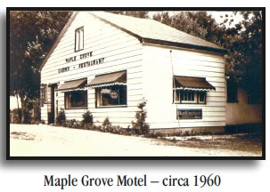
In 1940, Eva Viola (Asling) Tinney and Albert Victor Tinney sold “lots 9 to 12” to William Henry and Eujean Laura Conn for $6,000. William Henry Conn (1893-1965) was from Nova Scotia and came to Brighton in the 1930s, quickly becoming one of the most active real estate speculators and businessmen. He constantly bought and sold property and businesses, resulting in his name being prominent in land records as well as the book History of Brighton Businesses. William H. and Laura Conn remained in Brighton and are buried in Mount Hope Cemetery. Unfortunately, there is no connection with any families in the area, so this Conn family has not been added to www.treesbydan.com. On taking over Tinney Cabins and Service Station, William Conn named the business “Maple Grove Cabins” and added a restaurant.
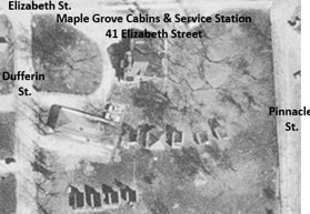
The name Maple Grove Cabins stuck as the business was taken over by Lloyd B. Gohn in 1945, with reopening May 18, 1946. On Jul 17 1951, there were two complex land transfers. In the first one, William Conn sold the property called “Lots 9 to 12 south Elizabeth St.” to Lloyd Gohn for $10,800. However, there were a lot more pieces of property included in this transaction, including lots on Lambton St., Dufferin St. and Ferris Street. On the same day, the second transaction is all the same property being sold to Squire and Lillian Binks. Maple Grove Cabins continued to operate under this new owner.
Then, at the very end of 1956, Squire and Lillian Binks sold Maple Grove Cabins to Lawrence and Edith Pattison, along with all those other lots around town. The Pattison’s operated what was now called Maple Grove Restaurant and Motel.
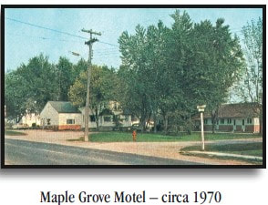
Ownership changed again in September 1962 when Lawrence and Edith Pattison sold Maple Grove Restaurant and Motel to Gordon and Helen Atkins, along with the lots on Dufferin and Lambton Streets. This Atkins family was from Belleville and not related to the Atkins family at Presqu’ile and Brighton. They operated the business until 1967 when it was sold to Elliot and Thelma Perry. These folks are shown to be “motel owners” in the 1968 Canada Voters Lists.
Then, the land records show four transactions, all dates May 14 1971, where Elliot and Thelma Perry sold each of the four lots, 9 to 12, Elizabeth Street South, to John and Frances Pope. During this time the facilities at 41 Elizabeth Street were providing accommodations for people. The 1972 Canada Voters Lists shows that Douglas Hodgson, a retail salesman, and his wife Patricia lived there, along with George Parkinson, a bricklayer and his wife Gladys. Also, we see June Coughler, called a Supervisor, which may be related to the motel.
Ownership changed again in September 1962 when Lawrence and Edith Pattison sold Maple Grove Restaurant and Motel to Gordon and Helen Atkins, along with the lots on Dufferin and Lambton Streets. This Atkins family was from Belleville and not related to the Atkins family at Presqu’ile and Brighton. They operated the business until 1967 when it was sold to Elliot and Thelma Perry. These folks are shown to be “motel owners” in the 1968 Canada Voters Lists.
Then, the land records show four transactions, all dates May 14 1971, where Elliot and Thelma Perry sold each of the four lots, 9 to 12, Elizabeth Street South, to John and Frances Pope. During this time the facilities at 41 Elizabeth Street were providing accommodations for people. The 1972 Canada Voters Lists shows that Douglas Hodgson, a retail salesman, and his wife Patricia lived there, along with George Parkinson, a bricklayer and his wife Gladys. Also, we see June Coughler, called a Supervisor, which may be related to the motel.
|
|
Almost exactly a year later, the same kind of transactions show that John and Frances Pope sold these four lots to Patricia and Evanlena Hodgson. Many mortgage and discharge items later, in 1976, the Hodgson’s sold the lots to Vicary Masonry Construction Co. Ltd. Thus began the process by which these four lots, 9 to 12, which supported the cabins and gas station business, and then the motel and restaurant, experienced a complete change as the existing structures were removed and a commercial plaza was built, fronting on Elizabeth Street.
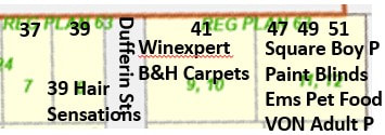
There were many different tenants in the units of this commercial mall and ownership changed hands several times. The details are in the transcription of land records, for anyone who is interested. However, it seems important to mention that Claude and Pauline Hilwerda’s B&H Carpets, a mainstay in Brighton business and community, was established in 41 Elizabeth Street in 1999, after being at 39 Elizabeth Street for a short time. As of this writing in 2026, B&H Carpets is still there, and much expanded.
47, 49 & 51 Elizabeth Street
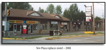
The addresses of 47, 49 and 51 Elizabeth Street are contained in the eastern section of the commercial plaza which extends to Pinnacle St. South. This building stands in Lots 11 and 12 of the old Plan 63, and is distinctly different from the building beside it which is in Lot 9 and 10, although they butt against each other.
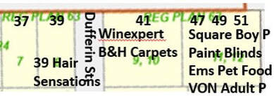
This means that the land record are the same for both buildings up to 1987 when Coles Select, who had acquired Lots 11 and 12 in 1984, sold to Richard Seguire. In 1989, Seguire sold to Alexander Judson who soon sold to Coles Select. Judson Donuts was a tenant in 49 and 51 from June 1987 to 1995.
The last transaction available in public records was in 2005 when Coles Select sold to 1622269 Ontario Ltd.
As with 41 Elizabeth St., the details of tenants in the units can be seen in the analysis for this property.
The last transaction available in public records was in 2005 when Coles Select sold to 1622269 Ontario Ltd.
As with 41 Elizabeth St., the details of tenants in the units can be seen in the analysis for this property.
75 Elizabeth Street
The property on the south side of Elizabeth Street that is immediately east of Pinnacle Street South hosts the King Edward Park Arena and Community Centre. The address is 75 Elizabeth Street.
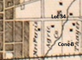
The Belden County Atlas map of 1878 shows the position of this property on the south side of Elizabeth Street and east of Pinnacle Street South. Here, the land is labelled “Agric. Co.” which refers to the Union Agricultural Joint Stock Company which acquired this lot for a fairgrounds.
The Belden County Atlas map of 1878 shows the position of this property on the south side of Elizabeth Street and east of Pinnacle Street South. Here, the land is labelled “Agric. Co.” which refers to the Union Agricultural Joint Stock Company which acquired this lot for a fairgrounds.
We can see that the land is in lot 34 of concession B and it has not been sub-divided into village lots. This means that land registry records for this property are to be found under those for lot 34, concession B.
The Patent from the crown for all 200 acres of lot 34, concession B, Murray Township was granted to Kings College in 1828 and Kings College sold the west half of lot 34 in 1843 to James B. Greenshields. He then sold it in 1849 to Bernard Devlin.
James Blackwood Greenshields was born in Montreal to a wealthy merchant with origins in Scotland. After engaging in business and real estate speculation, this family returned to their estate called Kerse House in Lankashire, Scotland.
Bernard Devlin (1823-1913) was born in Picton, a son of Mark Devlin and Martha Wilson. This family lived in Brighton Village for a time in the later 1830s and into the 1850s. One son, John Wilson Devlin, owned a small village lot on the west side of Prince Edward Street, near Richardson Street, where he worked as a shoemaker. Bernard Devlin engaged in speculation on the west half of lot 34, Concession B, turning it around quickly and then moving to Belleville.
After this transaction in October 1850, the property was now owned by William Butler (1800-1875), a wealthy mill owner to the south-east of Brighton and a very active player in land speculation during a time of intense growth and change. Only two years before, he had completed the construction if his large, impressive two-storey brick home on the main road south-east of Brighton. This was the house that Gordon Tobey revitalized in the 1980s, preserving the structure to a remarkable degree.
William Butler was constantly buying and selling pieces of property around the south and east part of Brighton, taking advantage of opportunities to turn a profit. He held on to this land for a while, selling a small bit to the Grand Trunk Railway in 1856 and then taking out a mortgage with James L. Biggar of Carrying Place in 1872.
Mr. Butler owned the 19 acres south of Elizabeth Street in 1876 when he passed away, and his estate sold it to the Union Agricultural Join Stock Company for $9,119.52. This company was formed by local investors to manage the Brighton Fair Grounds where horse races and agricultural competitions and lots of other events would entertain and educate the community for many years.
The Patent from the crown for all 200 acres of lot 34, concession B, Murray Township was granted to Kings College in 1828 and Kings College sold the west half of lot 34 in 1843 to James B. Greenshields. He then sold it in 1849 to Bernard Devlin.
James Blackwood Greenshields was born in Montreal to a wealthy merchant with origins in Scotland. After engaging in business and real estate speculation, this family returned to their estate called Kerse House in Lankashire, Scotland.
Bernard Devlin (1823-1913) was born in Picton, a son of Mark Devlin and Martha Wilson. This family lived in Brighton Village for a time in the later 1830s and into the 1850s. One son, John Wilson Devlin, owned a small village lot on the west side of Prince Edward Street, near Richardson Street, where he worked as a shoemaker. Bernard Devlin engaged in speculation on the west half of lot 34, Concession B, turning it around quickly and then moving to Belleville.
After this transaction in October 1850, the property was now owned by William Butler (1800-1875), a wealthy mill owner to the south-east of Brighton and a very active player in land speculation during a time of intense growth and change. Only two years before, he had completed the construction if his large, impressive two-storey brick home on the main road south-east of Brighton. This was the house that Gordon Tobey revitalized in the 1980s, preserving the structure to a remarkable degree.
William Butler was constantly buying and selling pieces of property around the south and east part of Brighton, taking advantage of opportunities to turn a profit. He held on to this land for a while, selling a small bit to the Grand Trunk Railway in 1856 and then taking out a mortgage with James L. Biggar of Carrying Place in 1872.
Mr. Butler owned the 19 acres south of Elizabeth Street in 1876 when he passed away, and his estate sold it to the Union Agricultural Join Stock Company for $9,119.52. This company was formed by local investors to manage the Brighton Fair Grounds where horse races and agricultural competitions and lots of other events would entertain and educate the community for many years.
This piece in the Tobey Book is from the Brighton Ensign newspaper on February 7, 1873:
"Union Agricultural Joint Stock Company: On Saturday the shareholders of the above Company met at Clark’ s Hotel in the village and organized by W. Gibbard, Esq., being appointed Chairman, and Mr. P. Begg of the ENSIGN, Secretary. The rules and regulations which had been prepared by Mr. Lockwood who has been most indefatigable in his exertions for the benefit of the Society were received and adopted. It provides for a Company to secure lands for a Driving Park, Agricultural buildings to be used for shows and other purposes. Directors appointed M. Mordin, Hugh McQuoid, M. K. Lockwood, John Eyre, W. C. Proctor, Robert Macklen, Gilbert Jones, W. J. Bedwill, A. A. Becker, an auditor, M.P. Ketchum. They will have to choose the grounds, decide on what kind of buildings to be erected.”
"Union Agricultural Joint Stock Company: On Saturday the shareholders of the above Company met at Clark’ s Hotel in the village and organized by W. Gibbard, Esq., being appointed Chairman, and Mr. P. Begg of the ENSIGN, Secretary. The rules and regulations which had been prepared by Mr. Lockwood who has been most indefatigable in his exertions for the benefit of the Society were received and adopted. It provides for a Company to secure lands for a Driving Park, Agricultural buildings to be used for shows and other purposes. Directors appointed M. Mordin, Hugh McQuoid, M. K. Lockwood, John Eyre, W. C. Proctor, Robert Macklen, Gilbert Jones, W. J. Bedwill, A. A. Becker, an auditor, M.P. Ketchum. They will have to choose the grounds, decide on what kind of buildings to be erected.”
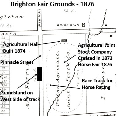
At right is a snip of the Belden County Atlas Map (1878) for Brighton Township which shows that the Union Agricultural Joint Stock Company owns 19 acres of land south of Elizabeth Street and east of Pinnacle Street. Labels have been added to illustrate the facilities that were created here in 1874 in order to give the community a real, functional fair grounds.
The race track took up the bulk of the 19 acres and was designed in an oval shape on a north-south axis. The Agricultural Hall was built at the north end of the race track, not far from Elizabeth Street. A large grandstand was located on the west side of the track, on what is now Pinnacle Street South and, to some degree, on the lawns of the houses in that area.
The race track took up the bulk of the 19 acres and was designed in an oval shape on a north-south axis. The Agricultural Hall was built at the north end of the race track, not far from Elizabeth Street. A large grandstand was located on the west side of the track, on what is now Pinnacle Street South and, to some degree, on the lawns of the houses in that area.
The first major exhibition to be held in the new Agricultural Hall was created by the Horticultural Society with the chief exhibitors a who’s who of Brighton “Mrs. Platt, Mrs. John Bradd, Mrs. Burrill, John Bowles, Miss Bidwell, H. Gill, and W.D. Symington. Mr. Drewry showed a most magnificent oleander.” The formal opening of the new facility was held on September 25, 1874 with a fun community event that the newspaper reporter called “a monster picnic”, which rather speaks for itself.
In 1876 a horse fair was held which included awards for all sorts of individuals and teams which had the effect of demonstrating how important horses remained to the community. In the same year a fox hunt was held where the hounds appeared rather afraid of the fox but eventually caught it, as was the point of the event. While there was optimism about continued events like this, the fox hunt soon fell out of favour.
The fair grounds were often used to stage parades and one good example was the celebration of the Queen’s Jubilee in 1897 when the streets were hung with endless bunting and a large crowd gathered along Main Street to hear the bands and see the parade go by. In the end, the parade went to the fair grounds where there was room for everyone to dismantle their displays and get ready for the banquet at the Opera House that night.
In 1876 a horse fair was held which included awards for all sorts of individuals and teams which had the effect of demonstrating how important horses remained to the community. In the same year a fox hunt was held where the hounds appeared rather afraid of the fox but eventually caught it, as was the point of the event. While there was optimism about continued events like this, the fox hunt soon fell out of favour.
The fair grounds were often used to stage parades and one good example was the celebration of the Queen’s Jubilee in 1897 when the streets were hung with endless bunting and a large crowd gathered along Main Street to hear the bands and see the parade go by. In the end, the parade went to the fair grounds where there was room for everyone to dismantle their displays and get ready for the banquet at the Opera House that night.
The fair grounds also supported monthly shooting competitions put on by the Brighton Fun Club. One such event, was called “a most enjoyable shoot on New Year's Day”.
In 1903, the Union Agricultural Joint Stock Company was liquidated after being in existence for over 30 years. The 19 acres went to Thomas Whitford Solomon (1839-1916), a son of Thomas Solomon and Fedelia Elizabeth Ewing. He remained single and is often seen living with his older brother, James Ewing Solomon. However, in 1901 he is living with Benjamin Ewing, in the large Ewing home on Main Street. Records show that both men were single, their families had means, and they engaged in various real estate investments.
Then, in 1910, a group of local citizens formed the King Edward Park Association and decided to purchase the 19 acres, then known as the Agricultural Grounds. The place was named King Edward Park. The race track was refurbished and in 1923 a new grandstand was erected.
In 1903, the Union Agricultural Joint Stock Company was liquidated after being in existence for over 30 years. The 19 acres went to Thomas Whitford Solomon (1839-1916), a son of Thomas Solomon and Fedelia Elizabeth Ewing. He remained single and is often seen living with his older brother, James Ewing Solomon. However, in 1901 he is living with Benjamin Ewing, in the large Ewing home on Main Street. Records show that both men were single, their families had means, and they engaged in various real estate investments.
Then, in 1910, a group of local citizens formed the King Edward Park Association and decided to purchase the 19 acres, then known as the Agricultural Grounds. The place was named King Edward Park. The race track was refurbished and in 1923 a new grandstand was erected.
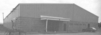
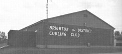
In May 1933, The King Edward Park Association sold the 19 acres of the park to the Corporation of the Village of Brighton for $1,200. Two decades later, on October 15, 1954, Hurricane Hazel knocked down the grandstand and it was not replaced. In 1950 an arena was built and paid for my voluntary contributions. As a kid growing up on a farm at Codrington, I recall going to the arena to skate and play hockey. In 1965, a By-Law was passed to allow the leasing of part of the park and soon Brighton provided a lease for land to the east of the arena for the Brighton and District Curling Club.
|
|
A serious problem arose in 1976 when the old arena was condemned by the Province. The solution was to bring Brighton Village and Brighton Township into agreement to build a new and much more modern arena.
Today, King Edward Park hosts the community centre, the hockey arena, the curling club, several ball diamonds and soccer fields. There are also playgrounds, tennis courts and the new pickle ball courts.
Today, King Edward Park hosts the community centre, the hockey arena, the curling club, several ball diamonds and soccer fields. There are also playgrounds, tennis courts and the new pickle ball courts.
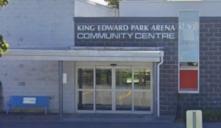
|
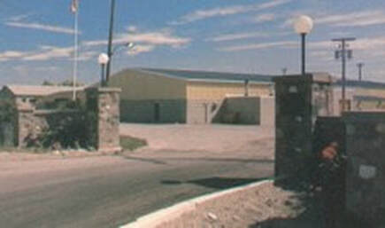
|
85 Elizabeth Street
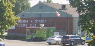
The building immediately east of the King Edward Park Community Centre is the Brighton Curling Club which is 85 Elizabeth Street.
This appeared in “They Way We Were”, on page 209:
“In the spring of 1964, a prize presentation and trophy night was held at the Legion in Brighton and it was decided that if one hundred memberships could be sold at $100 each, we would build a curling club of our own. Through the efforts of Arlo Stranden, Mel Doherty and others, the goal was reached that summer and the ground was broken for the building of the club. Ed Solomon was the Reeve of Brighton Village at the time and he and his Council agreed to give the Brighton and District Curling Club a 99 -year lease for $ 1.00 per year on the property in King Edward Park where the building now stands. A contract was let to Warkworth Lumber for the construction and the ice machine was provided by Canadian Ice Machine Company. If memory is right, the total cost of the building, ice equipment, curling stones and furniture was less than $100,000!”
In 1965, a By-Law was passed to allow the leasing of part of King Edward Park and soon Brighton provided a lease for land to the east of the arena for the Brighton and District Curling Club.
Before that, the history of this property is the same as for the community centre.
This appeared in “They Way We Were”, on page 209:
“In the spring of 1964, a prize presentation and trophy night was held at the Legion in Brighton and it was decided that if one hundred memberships could be sold at $100 each, we would build a curling club of our own. Through the efforts of Arlo Stranden, Mel Doherty and others, the goal was reached that summer and the ground was broken for the building of the club. Ed Solomon was the Reeve of Brighton Village at the time and he and his Council agreed to give the Brighton and District Curling Club a 99 -year lease for $ 1.00 per year on the property in King Edward Park where the building now stands. A contract was let to Warkworth Lumber for the construction and the ice machine was provided by Canadian Ice Machine Company. If memory is right, the total cost of the building, ice equipment, curling stones and furniture was less than $100,000!”
In 1965, a By-Law was passed to allow the leasing of part of King Edward Park and soon Brighton provided a lease for land to the east of the arena for the Brighton and District Curling Club.
Before that, the history of this property is the same as for the community centre.
115 Elizabeth Street
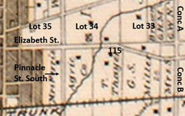
The property at 115 Elizabeth Street is on the east side of King Edward Park, which means at the eastern border of lot 34. The Belden County Atlas map of 1878 shows the position of this property on the south side of Elizabeth Street and inside the eastern border between lot 33 and 34.
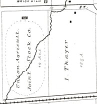
This land is called the east half of lot 34 and this map shows the label “T. Thayer” which should say “I. Thayer”, meaning Isaiah Thayer, the fellow who operated the nursery business on Prince Edward Street. The Brighton Plan of 1866 shows it correctly as “I. Thayer”.
The Patent from the Crown for all 200 acres of Lot 34, Concession B, Murray Township as granted to Kings College and in 1833 George S. Marsh provided Bond for the east half 20 acres to Isaiah Thayer. Another transaction, in 1856, shows that the University of Toronto granted the north 20 acres of the east half of lot 34 to Isaiah Thayer.
The Patent from the Crown for all 200 acres of Lot 34, Concession B, Murray Township as granted to Kings College and in 1833 George S. Marsh provided Bond for the east half 20 acres to Isaiah Thayer. Another transaction, in 1856, shows that the University of Toronto granted the north 20 acres of the east half of lot 34 to Isaiah Thayer.
Two brothers, Nathaniel Thayer (1791-1878) and Isaiah Thayer (1798-1876), had come from Massachusetts in the early 1820s to settle in Upper Canada. Nathaniel married Fanny Drewry and had a family of five. Isaiah, however, remained unmarried but both men would have an impact on the new community. They farmed on land along the east side of what we call Prince Edward Street, and, over time, the family developed an extensive nursery business that would be a central asset in the development of the apple business in Brighton.
Nathaniel Thayer remained on Prince Edward Street and Isaiah Thayer made a home for himself on the 20 acres south of Elizabeth Street well east of the village of Brighton. Based on the snip of the 1960s aerial photo at right, this researcher speculates that the large building immediately south of what is now #115 was the Thayer/Solomon homestead. This coordinates with the black squares on the 1878 Belden Atlas map, just above, which shows “I. Thayer” as the owner of the property.
Isaiah Thayer died in January 1876 and later that year Nathanial Thayer passed the 20 acres to his son, Isaiah B. Thayer (1833-1914) who had married Mary Jemima Locklin. He would sell the 20 acres in 1881 to James Ewing Solomon (1834-1916) who had married Isaiah B.’s sister Fanny Thayer. Then, in 1916, the Estate of James E. Solomon passed the 20 acres to his son Ira Blanchard Solomon (1871-1964) who was married to Florence Evelyn Kennedy and would become a prominent fruit grower in the area, partly due to the orchards on this property. This is why, in common parlance, this homestead was called the Solomon place. Here we will call it the Thayer/Solomon place.
Nathaniel Thayer remained on Prince Edward Street and Isaiah Thayer made a home for himself on the 20 acres south of Elizabeth Street well east of the village of Brighton. Based on the snip of the 1960s aerial photo at right, this researcher speculates that the large building immediately south of what is now #115 was the Thayer/Solomon homestead. This coordinates with the black squares on the 1878 Belden Atlas map, just above, which shows “I. Thayer” as the owner of the property.
Isaiah Thayer died in January 1876 and later that year Nathanial Thayer passed the 20 acres to his son, Isaiah B. Thayer (1833-1914) who had married Mary Jemima Locklin. He would sell the 20 acres in 1881 to James Ewing Solomon (1834-1916) who had married Isaiah B.’s sister Fanny Thayer. Then, in 1916, the Estate of James E. Solomon passed the 20 acres to his son Ira Blanchard Solomon (1871-1964) who was married to Florence Evelyn Kennedy and would become a prominent fruit grower in the area, partly due to the orchards on this property. This is why, in common parlance, this homestead was called the Solomon place. Here we will call it the Thayer/Solomon place.
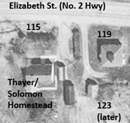
In 1948, Ira B. Solomon sold the 20 acres to Gordon Ewart Mallory (1886-1966) who was from Percy Township and part a long line of early loyalists, going back to Caleb Mallory (1781-1867). He and his wife Agnes then sold the property to Ruel C. Annesley and his wife Alexandra for $13,500. They are shown as the occupants of 155 Elizabeth Street in the 1965, 1968 and 1972 Canada Voters Lists.
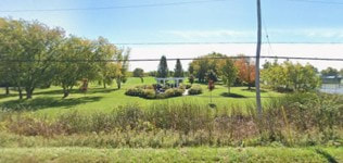
There is a land transaction in 1974 which appears to show that Ruel and Alexandra Annesley granted part of the west side of their property to the Corporation of the Village of Brighton. This resulted in the lovely garden and lawns and soccer fields to the east side of Prince Edward Park near the road.
There is no connection for this Annesley family to anyone in www.treesbydan.com so they have not been added to the database. However, records show that Ruel Annesley died in Quebec Aug 26 1974. His wife, Alexandra, died in Trenton in 2003.
Also in 1974, there was sale by Brighton under Plan 38R488 where Brighton granted land related to the estate of Agnes Mallory to Anthony and Shirley Dhaene. This couple appears to be living at 115 Elizabeth Street at least through 1999.
Also in 1974, there was sale by Brighton under Plan 38R488 where Brighton granted land related to the estate of Agnes Mallory to Anthony and Shirley Dhaene. This couple appears to be living at 115 Elizabeth Street at least through 1999.
119 Elizabeth Street
The property at 119 Elizabeth Street is immediately east of #115, also in lot 34. This picture snipped from Google Maps is taken from Elizabeth Street looking south and shows #115 on the right, #119 on the left. In the background and not so visible is #123 which is south of #119, only the garage is showing here. Driveways directly off the street provide access to #115 and #119, but there is a driveway east of #119 which goes down to #123.
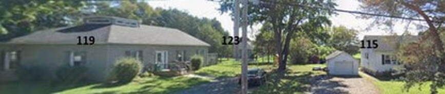
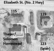
The aerial photo of these properties shows that, in the 1960s, there was a house south of #115, which may have been the old Solomon farm house. That structure no longer exists and the property south of #115 is now part of King Edward Park. The photo also shows that the modern house at #119 has been built, but the newer house that is now #123, has not been built yet. Also, the road that used to go south on the west side of #119 now goes down the east side of that home to #123.
The land records for #119 are the same as #115 until 1958 when Ira B. Solomon grants part of the property to himself and his daughter, Frances K. Solomon. Ira B.’s wife, Frances Evelyn (Kennedy) Solomon had died the previous year and this would provide a home for Frances Kennedy Solomon (1906-1978) who remained single and worked as a music teacher. Interestingly, the Canada Voters Lists show Frances Solomon, music teacher, living in 123 Elizabeth Street in 1965, then at 119 Elizabeth Street in 1968 and 1972. In 1974 Frances K. Solomon sold #119 to Ronald and Geneva Kinney and they sold in 2002 to Kimberley Ann Conley.
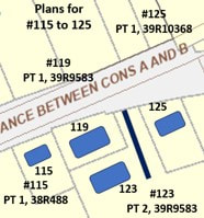
The map at right is based on a snip from the OnLand.ca system which shows the modern land divisions in this area. The blue rectangles are added by the author in order to show the relative positions of the houses. Plans that are relevant to these properties are noted as well.
123 Elizabeth Street
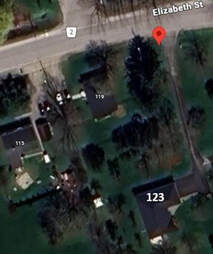
When we search in Google Maps for 123 Eizabeth Street, Brighton, the red dot goes to the driveway on Elizabeth Street, east of #119. This very long driveway goes south to the house which is #123. See the satellite view at right.
Land records for this property are the same as for #119 until 1958 when Ira B. Solomon sold land to his daughter, Frances K. Solomon. In 1974, she sold the property that would be 119 and 123 Elizabeth Street to Ronald and Geneva Kinney.
In 2001 they took a mortgage on Parts 1 and 2 of Plan 39R-9583 and in 2002 they sold Part 2 (#123) to Kimberley Ann Conley. The same owner is present in land records to at least 2007.
Land records for this property are the same as for #119 until 1958 when Ira B. Solomon sold land to his daughter, Frances K. Solomon. In 1974, she sold the property that would be 119 and 123 Elizabeth Street to Ronald and Geneva Kinney.
In 2001 they took a mortgage on Parts 1 and 2 of Plan 39R-9583 and in 2002 they sold Part 2 (#123) to Kimberley Ann Conley. The same owner is present in land records to at least 2007.
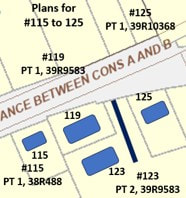
Based on the OnLand.ca map of this area and the blue rectangles for houses added by me, we can see that #119 is Part 1 of 39R9583 and #123 is Part 2 of the same 39R9583. Part 1 is represented in land records before the end of records in 2008 but Part 2 is not.
125 Elizabeth Street
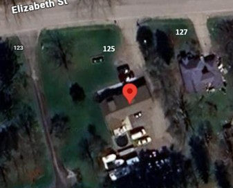
The property at 125 Elizabeth Street displays a large lawn with trees and a large modern house set back from the road. A sign in front of the house says “J C K Construction”. Access is directly from Elizabeth Street and not through the driveway to the west which goes down to #123.
Land records for #125 are the same as 123 up to 1952 when Ira B. Solomon sells 2 acres to the Veterans Land Act.
Canada Voters Lists show that in 1965 Cameron and May Valley lived at 125 Elizabeth Street. The 1972 record adds that he was with Tippet-Richardson and there was a William at the same address.
Land records for #125 are the same as 123 up to 1952 when Ira B. Solomon sells 2 acres to the Veterans Land Act.
Canada Voters Lists show that in 1965 Cameron and May Valley lived at 125 Elizabeth Street. The 1972 record adds that he was with Tippet-Richardson and there was a William at the same address.
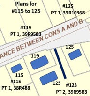
Then, in 1982 the Veterans Land Act sold the property to Mary Harriet Valley and in 2002 she sold to Michel Charles and Kimberly Yvonne Phelan, the land identified as Part 1 on 39R-9910.
In January 2004, this plan was divided in two, identified as R-Plan 39R-10368. Soon after this, Michael and Kimberly Phelan sold Part 2 on 39R-10368 to Ronald and Geneva Kinney which would add to their property at #123.
In January 2004, this plan was divided in two, identified as R-Plan 39R-10368. Soon after this, Michael and Kimberly Phelan sold Part 2 on 39R-10368 to Ronald and Geneva Kinney which would add to their property at #123.
In January 2004, this plan was divided in two, identified as R-Plan 39R-10368. Soon after this, Michael and Kimberly Phelan sold Part 2 on 39R-10368 to Ronald and Geneva Kinney which would add to their property at #123.
In the next month, Michael and Kimberly Phelan sold Part 1 on 39R-10368 to Joseph Leslie and Irene Louise McSpadden which represents the main property of #125.
In the next month, Michael and Kimberly Phelan sold Part 1 on 39R-10368 to Joseph Leslie and Irene Louise McSpadden which represents the main property of #125.
127 Elizabeth Street
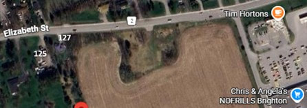
There is no longer a house at 127 Elizabeth Street. All we can see from the road is bushes and the hint of a large worked field to the south. Before the house was removed, it was at the north end of a long and narrow lot which was along the east side of lot 34, adjacent to lot 33.
A small snip of the modern OnLand.ca map shows the land divisions in that area with the street addresses added for reference.
A snip of the aerial photos of Brighton in the 1960s shows that there is a house at #127, just east of #125. We can also see clearly that the house was on a narrow lot with the border between lot 34 and lot 33 just east of the house.
A snip of the aerial photos of Brighton in the 1960s shows that there is a house at #127, just east of #125. We can also see clearly that the house was on a narrow lot with the border between lot 34 and lot 33 just east of the house.
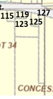
|
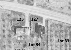
|
Land records for #127 are found in the pages for lot 34, concession B, the same as for #115, #119 and #125. The records for #127 diverge from the others in 1971 when the Veterans Land Act sold part of this land (which Ira B. Solomon sold to it earlier) to George Williamson who quickly turned it around to Ronald Wilkinson.
In 1973, Wilkinson sold the property to James and Gladys Simpson who had it until 1985, then sold to Guy & Patricia Quirion. They sold the next year to Harold Keith Wayne and Theresa Mary Terry of Trenton. Theresa died in 2005 and Harold sold #127 to Kevin Paul Harris.
In 1973, Wilkinson sold the property to James and Gladys Simpson who had it until 1985, then sold to Guy & Patricia Quirion. They sold the next year to Harold Keith Wayne and Theresa Mary Terry of Trenton. Theresa died in 2005 and Harold sold #127 to Kevin Paul Harris.
129 Elizabeth Street
If we search for 129 Elizabeth Street in Google Maps, the result is from September 2024 and it shows a paved driveway leading to a grassy area, with fields to the south. This is just east of #127 and No Frills can be seen off to the south-east on the left side of the picture. In the summer of 2026, there was intense construction working being done in this area.
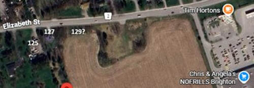
The key to understanding this scenario may be the Google Maps aerial photo of this area, shown here. Back in 2024, there was a worked field surrounding a square space at the highway. There were no buildings there at that time, but the shape and size of the space, along with the trees and bushes, along with that obvious driveway, suggest the centre of a farm at one point, including a house and outbuildings.
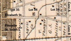
An important distinction to make for this property is that it is in Lot 33, Concession B. We have crossed the boarder between Lot 33 and Lot 34 when we move east of 127 Elizabeth Street. That means land records for 129 and 155 Elizabeth Street are found under Lot 33.
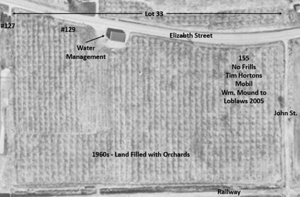
Another view of this property is the 1960s aerial photo at left which shows a large orchard filling almost the whole space of lot 33 north of the railway tracks. This would be the Mound orchards. There is only one building in this area, and that is a water management facility near the road, a bit west of centre in the lot. This would be removed soon. It is important to emphasize that there was no homestead or even a house on this property before the development happened in the 1980s. It was orchard.
The Patent from the Crown for all 200 acres of lot 33, concession B, Murray Twp. was granted to Joseph Forsyth, a very active merchant in Kingston who invested in properties across a wide region, including Prince Edward County and the eastern parts of Northumberland County. In 1812, Forsyth sold all 200 acres of lot 33 to John Nix Sr. He was a very early settler on the north shore of Presqu’ile Bay and the builder, along with his son, John Nix Jr., of the wharf at the east end of Price Street in Gosport.
Mr. Nix held lot 33 until 1849 when he sold 50 acres of the west part to his daughter, Maria (Nix) Covell (1810-1898) who was married to David Covell. Then, in 1852, the Estate of John Nix Sr. granted 20 acres of the north west quarter of lot 33 to Josiah D. Wellington. He was a sailor who came to Presqu’ile just after the War of 1812 and married the widow Elizabeth (Gibson) Selleck. In 1857, Josiah passed the land on to his son, Isaac M. Wellington, a baker in Brighton and a historian of some note. He held the land until 1873 when he sold it to Cecil A. Harnes, a speculator, and he sold it the next year to James Nesbitt who was a merchant in Brighton and was investing in real estate around the town.
In 1876, he sold to George S. Miller, another very active investor, who sold very quickly to Cecil A. Harnes, then George Miller and on to Thomas Pake and soon to Hiram Scripture. Descriptions of land are a bit uncertain here and the next transaction that may be pertinent was in 1908, the will of William Jeremiah Scripture where it says “35 acres north of RR” goes to a son, Brock Scripture. There are several mortgages by Brock Scripture and one, in 1923 uses the description “east and west halves” for the first time.
In 1926, William R. Fraser provided a mortgage on the property and the next thing we see is Mr. Fraser selling the property to Arthur W. and Hazel P. Dewey for $23,800. Then, in 1931, the Deweys Quit Claimed the property to William R. Fraser. In 1944, he sold to Joseph Kopal who sold in 1945 to Joseph McAnally (1913-1952).
Mr. Nix held lot 33 until 1849 when he sold 50 acres of the west part to his daughter, Maria (Nix) Covell (1810-1898) who was married to David Covell. Then, in 1852, the Estate of John Nix Sr. granted 20 acres of the north west quarter of lot 33 to Josiah D. Wellington. He was a sailor who came to Presqu’ile just after the War of 1812 and married the widow Elizabeth (Gibson) Selleck. In 1857, Josiah passed the land on to his son, Isaac M. Wellington, a baker in Brighton and a historian of some note. He held the land until 1873 when he sold it to Cecil A. Harnes, a speculator, and he sold it the next year to James Nesbitt who was a merchant in Brighton and was investing in real estate around the town.
In 1876, he sold to George S. Miller, another very active investor, who sold very quickly to Cecil A. Harnes, then George Miller and on to Thomas Pake and soon to Hiram Scripture. Descriptions of land are a bit uncertain here and the next transaction that may be pertinent was in 1908, the will of William Jeremiah Scripture where it says “35 acres north of RR” goes to a son, Brock Scripture. There are several mortgages by Brock Scripture and one, in 1923 uses the description “east and west halves” for the first time.
In 1926, William R. Fraser provided a mortgage on the property and the next thing we see is Mr. Fraser selling the property to Arthur W. and Hazel P. Dewey for $23,800. Then, in 1931, the Deweys Quit Claimed the property to William R. Fraser. In 1944, he sold to Joseph Kopal who sold in 1945 to Joseph McAnally (1913-1952).
This fellow was born in Ireland and immigrated with this family in 1927, living in Toronto. In May of 1945, Joseph McAnally purchased the Mid Way Service Station from William H. Conn who had recently built the station at 64 Elizabeth Street, on the north-east corner of Elizabeth and Terry Fox Way. Today that location is a plaza with variety store, pizza and sub shops, but for several decades it was a busy gas and service station. Also, McAnally was an agent for Argosy Transport at this location in 1949 and 1950. Unfortunately, in February 1950, there was a destructive fire which led to Joseph McAnally and his wife, Irene, to sell the property to Ivan O. Whalen who rebuilt and continued the service station at that location.
Then Joseph McAnally died suddenly on April 2, 1952, leaving no Will. Eventually the Supreme Court decided in favour of the widow and Joseph McAnally’s estate went to his wife, Irene McAnally. Not long after, on August 1, 1956, Irene McAnally sold what had been described as “east and west halves, north of railway” to Edwin and Olive Mound.
Edwin Richard “Ted” Mound (1909-1980) came to Canada from England around 1940 with his wife, Olive Mary Profitt (1911-2000) and they proceeded to have five children. Ted Mound was the manager of the fish hatchery at Codrington and the family lived south of the village on County Road 27. The main asset at Lot 33, Concession B, near the highway, was an orchard of apple trees.
In 1956, Ted and Olive Mound purchased “35 acres, east & west halves lying north of C.N.R. and part road allowance between Conc A & B” as Joint Tenants. Then, in 1967, Ted and Olive Mound purchased a property east of there on the north side of the road, in lot 28, concession A and made this their new home. This historian recalls that my grandfather, Lloyd Ames of Codrington, picked apples at the Mound orchard for several years around this time.
Then Joseph McAnally died suddenly on April 2, 1952, leaving no Will. Eventually the Supreme Court decided in favour of the widow and Joseph McAnally’s estate went to his wife, Irene McAnally. Not long after, on August 1, 1956, Irene McAnally sold what had been described as “east and west halves, north of railway” to Edwin and Olive Mound.
Edwin Richard “Ted” Mound (1909-1980) came to Canada from England around 1940 with his wife, Olive Mary Profitt (1911-2000) and they proceeded to have five children. Ted Mound was the manager of the fish hatchery at Codrington and the family lived south of the village on County Road 27. The main asset at Lot 33, Concession B, near the highway, was an orchard of apple trees.
In 1956, Ted and Olive Mound purchased “35 acres, east & west halves lying north of C.N.R. and part road allowance between Conc A & B” as Joint Tenants. Then, in 1967, Ted and Olive Mound purchased a property east of there on the north side of the road, in lot 28, concession A and made this their new home. This historian recalls that my grandfather, Lloyd Ames of Codrington, picked apples at the Mound orchard for several years around this time.
By 1974, the municipality was looking for development in this area and there were numerous By-Laws passed, mostly to manage road allowances by “stopping up” any that were unused. Ted and Olive Mound gained small pieces of land as a result of this process. Ted Mound passed away on August 6, 1980 and in 1981, Plan 38R-3127 was registered in order to deal with the road allowances on land north of No. 2 Highway but in Lot 33. Over the next few years, several small pieces of land in this area were sold by Wesley and Bill Mound. However, that left the primary part of Lot 33 north of the railway available for development.
Then, in 1986, Olive Mound passed land to her sons, William Arthur and Wesley John Mound. This was related to Plan 38R-3127 which dealt with many small pieces of property north of Highway 2. There are many transactions related to this, but we should not be confused – they do not deal with the main land south of the road.
Olive Mound passed in 2000 and, on May 19 of that year, Plan 39R-9145 was registered, referring back to the item in 1956 when Ted and Olive Mound acquired 35 acres of the east and west halves north of the railway tracks. Actually, Plan 39R-9145 refers to the west half of the property.
Then, in 2003, the Estate of Olive Mary Mound, along with her children, granted “Part 1 on Plan 39R-9145” to Patricia and Edward Kennedy. Patricia Mound had married Edward Kennedy in the 1970s and this transaction matches anecdotal notes in the Tweedsmuir Histories of Codrington that "Mound has recently sold his orchards to his son-in-law, Edward Kennedy and his daughter, Patricia."
At the same time, the Estate of Olive Mound and her children sold the eastern half of lot 33 north of the tracks to Olive’s son, William Arthur Mound. Bill Mound (1956-2019) had a wife and four children. He was an avid environmentalist and worked in that field until his untimely death in 2019.
Then, in 1986, Olive Mound passed land to her sons, William Arthur and Wesley John Mound. This was related to Plan 38R-3127 which dealt with many small pieces of property north of Highway 2. There are many transactions related to this, but we should not be confused – they do not deal with the main land south of the road.
Olive Mound passed in 2000 and, on May 19 of that year, Plan 39R-9145 was registered, referring back to the item in 1956 when Ted and Olive Mound acquired 35 acres of the east and west halves north of the railway tracks. Actually, Plan 39R-9145 refers to the west half of the property.
Then, in 2003, the Estate of Olive Mary Mound, along with her children, granted “Part 1 on Plan 39R-9145” to Patricia and Edward Kennedy. Patricia Mound had married Edward Kennedy in the 1970s and this transaction matches anecdotal notes in the Tweedsmuir Histories of Codrington that "Mound has recently sold his orchards to his son-in-law, Edward Kennedy and his daughter, Patricia."
At the same time, the Estate of Olive Mound and her children sold the eastern half of lot 33 north of the tracks to Olive’s son, William Arthur Mound. Bill Mound (1956-2019) had a wife and four children. He was an avid environmentalist and worked in that field until his untimely death in 2019.
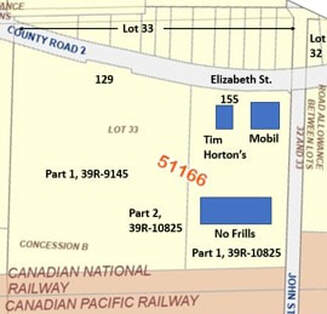
In this context, development was soon to come. Plan 39R-10825 was registered on May 6, 2005 and it covered the eastern half of lot 33 north of the tracks. Part 1 of the plan covered the part that was planned for development by Loblaws and Part 2 covered a strip on the west side of this which was not to be developed yet.
Then, on May 16, 2005, Bill Mound entered into Covenants with Loblaws for both Part 1 and Part of 2 of Plan 39R-10825. On the same day, another transaction shows that Bill Mound sold Part 1 of Plan 39R-10825 to Loblaws for a hefty sum. Another transaction on the same day transfers Part 2 of Plan 39R-10825 from Bill Mound to Bill Mound for $2. So, the western part containing orchards was not developed at this time. That is the part we can identify as 120 Elizabeth Street.
Then, on May 16, 2005, Bill Mound entered into Covenants with Loblaws for both Part 1 and Part of 2 of Plan 39R-10825. On the same day, another transaction shows that Bill Mound sold Part 1 of Plan 39R-10825 to Loblaws for a hefty sum. Another transaction on the same day transfers Part 2 of Plan 39R-10825 from Bill Mound to Bill Mound for $2. So, the western part containing orchards was not developed at this time. That is the part we can identify as 120 Elizabeth Street.
Later in 2005, Mike and Lori’s No Frills began operation at the address of 155 Elizabeth Street. The same store is operating in 2026 under different owners as Mike and Lori have a gardening store near Smithfield. Tim Horton’s was added later as well as the Mobil gas station.
In the summer of 2026, serious work began on structures close to the highway and immediately west of 155 Elizabeth Street, at 129 Elizabeth Street.
This marks the eastern extent of the analysis of Elizabeth Street South.
In the summer of 2026, serious work began on structures close to the highway and immediately west of 155 Elizabeth Street, at 129 Elizabeth Street.
This marks the eastern extent of the analysis of Elizabeth Street South.